5 days ago
Satellite Images Reveal Glacier-Linked Collapse Behind Nepal-China Floods

A huge flood struck areas near the Nepal-China border.
Hundreds of people were killed, and many others were still missing.
Scientists used satellite pictures to investigate what happened.
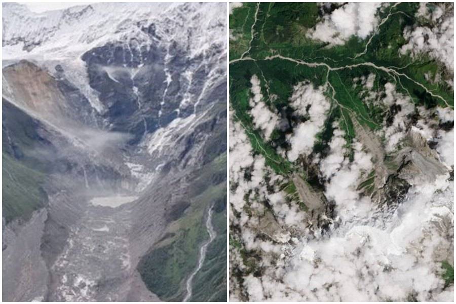
They found that part of a mountain and a glacier had collapsed together.
Rocks, ice, mud, and water then rushed down a narrow valley.
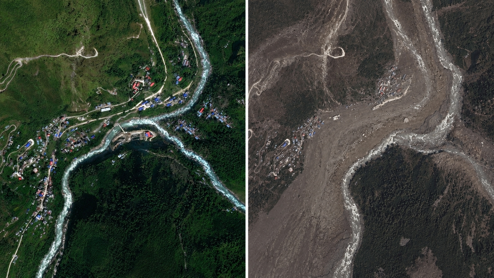
The debris buried villages and damaged towns beside the Trishuli River.
Some places now look brown because they are covered in mud and sediment.
One scientist believes warming temperatures helped make the mountain unstable.
Other scientists say they cannot yet prove that climate change directly caused this specific collapse.

Satellite images indicate that a large section of bedrock collapsed beneath a glacier near Langtang Lirung peak.
The collapse carried ice and boulders into a steep valley, where melting ice helped drive a destructive debris flow.
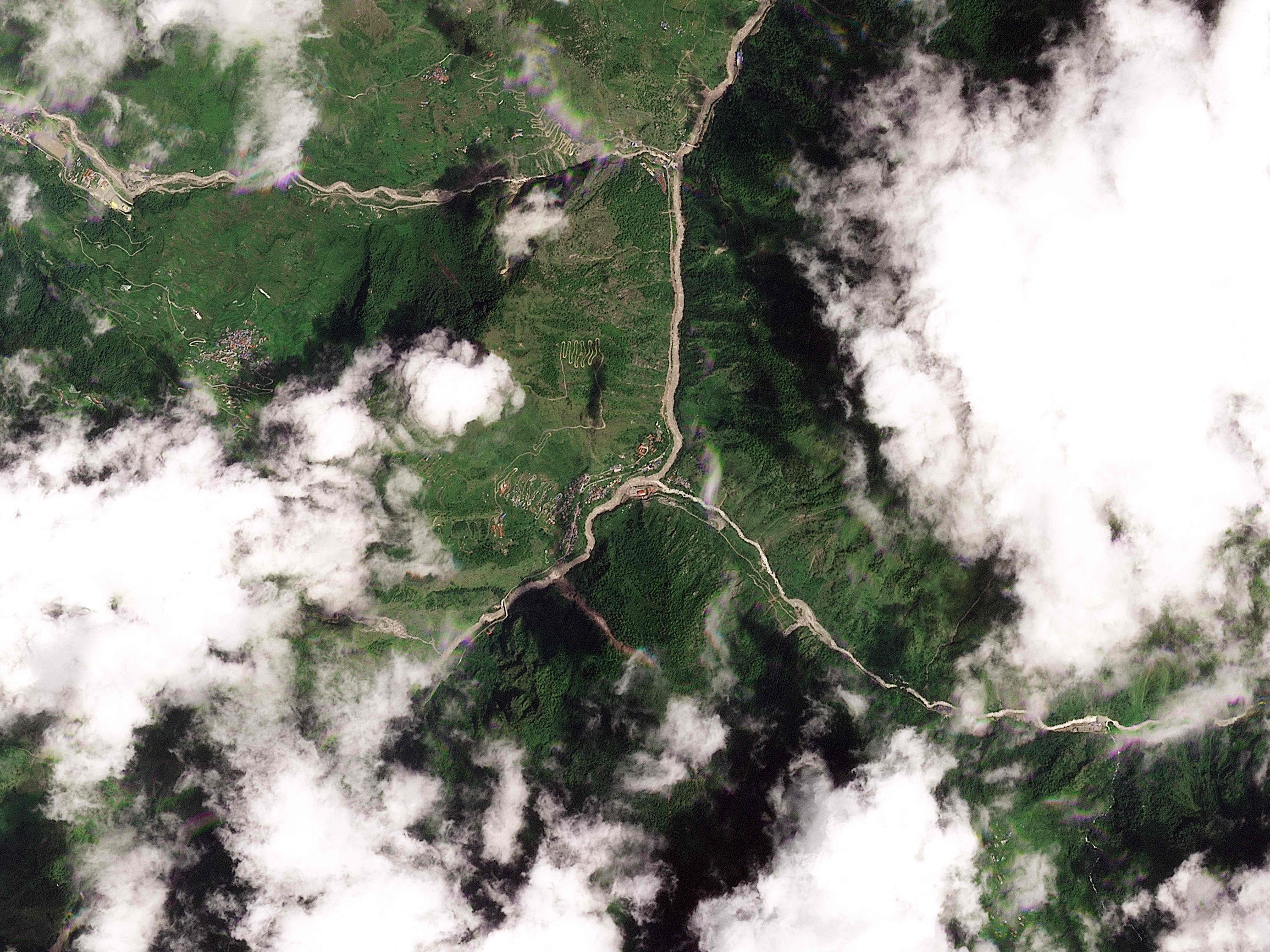
Floodwaters and mud swept through communities along Nepal’s Trishuli River, burying or destroying buildings.
The flooding killed hundreds of people, while many others remained missing, including foreigners and pilgrims.
Scientists disagree on whether climate change directly caused the collapse, though warming may increase the risk of similar events.
- Who
- Hundreds of people in Nepal and Tibet were killed, while residents, foreigners and pilgrims were among those missing; scientists and rescue teams investigated the disaster.
- What
- A glacier and a large section of underlying mountain bedrock collapsed, triggering a destructive flood and debris flow.
- Where
- Along the Nepal-China border, near Langtang Lirung peak and communities beside Nepal’s Trishuli River, including Kolpurtar, Betrawati and Syapru Besi.
- When
- The flooding occurred on Wednesday, and scientists reviewed clearer satellite images on Thursday; the report was published August 28, 2026.
- Why
- The collapse sent ice, boulders, mud and water into the valley; scientists are investigating whether warming temperatures contributed to mountain instability.
Climate change contributed
Direct link remains unproven
Cause of mountain instability
Climate change contributed
Alton Byers said the flooding was related to climate change, arguing that warming is melting glaciers and permafrost and weakening high-altitude rock, ice and soil.
Direct link remains unproven
Kristen Cook and Dan Shugar said they could not yet directly link this specific collapse to climate change; Cook noted that slope failures and landslides also occur naturally.
Future risk
Climate change contributed
Byers said warming-related instability can trigger cascading failures involving snow, ice, rock and water.
Direct link remains unproven
Cook said the event was not unexpected in a warming climate, but cautioned that future events of this scale should not be assumed or considered inevitable.
Key facts
- Reported deaths
- Hundreds of people were killed in Nepal and Tibet.
- Missing people
- Many remained missing, including scores of foreigners and pilgrims.
- Suspected trigger
- A large bedrock failure carried part of the Langtang Lirung glacier into the valley.
- Affected river
- The Trishuli River widened and carried heavy brown and black sediment.
- Damaged communities
- Kolpurtar, Betrawati and Syapru Besi were shown covered or surrounded by debris and mud.
- Recovery outlook
- A mountain geographer said the affected area could take many years to recover.
- Climate assessment
- Scientists said a direct climate-change link has not been established, although warming may increase the likelihood of similar events.
Quotes
Kristen Cook
Geomorphologist at the Université Grenoble Alpes studying glacial hazards and the flooding.
“While we cannot at this point directly link this collapse to climate change, it is not unexpected to see more events of this type with a warming climate.”
 thehindubusinessline.com
“You have this big bedrock failure that took part of the glacier with it.”
thehindubusinessline.com
Sources
Related news
Satellite Images Reveal Glacier Collapse Behind Nepal Border Floods
Glacier Collapse May Have Triggered Deadly Nepal Flood
Images Reveal Glacier Collapse Behind Nepal’s Deadly Flood
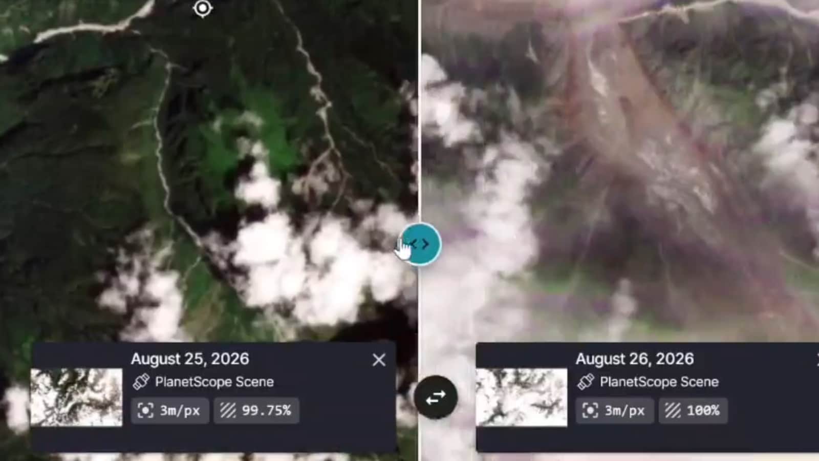
Satellite Images Reveal Possible Cause of Devastating Nepal Floods
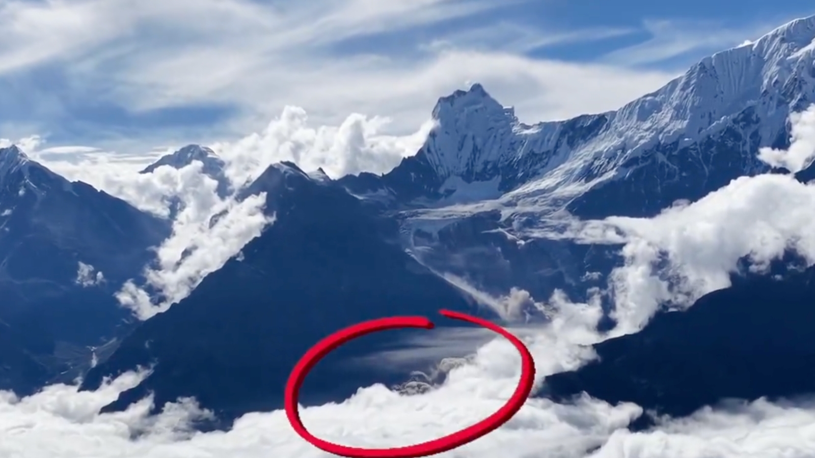
Drone Footage Reveals Glacier Collapse Behind Nepal-Tibet Floods

ISRO Images Link Nepal-Tibet Floods to Glacier Collapse

Scientists Find Two Ancient Human Lineages in Modern Genomes

Scientist Turns Insect Studies into Comics

Indian Students Settle Discrimination Case with US University
Hidden Faults Found in California Earthquake Hotspot