3 days ago
Satellite Images Reveal Glacier Collapse Behind Nepal Border Floods
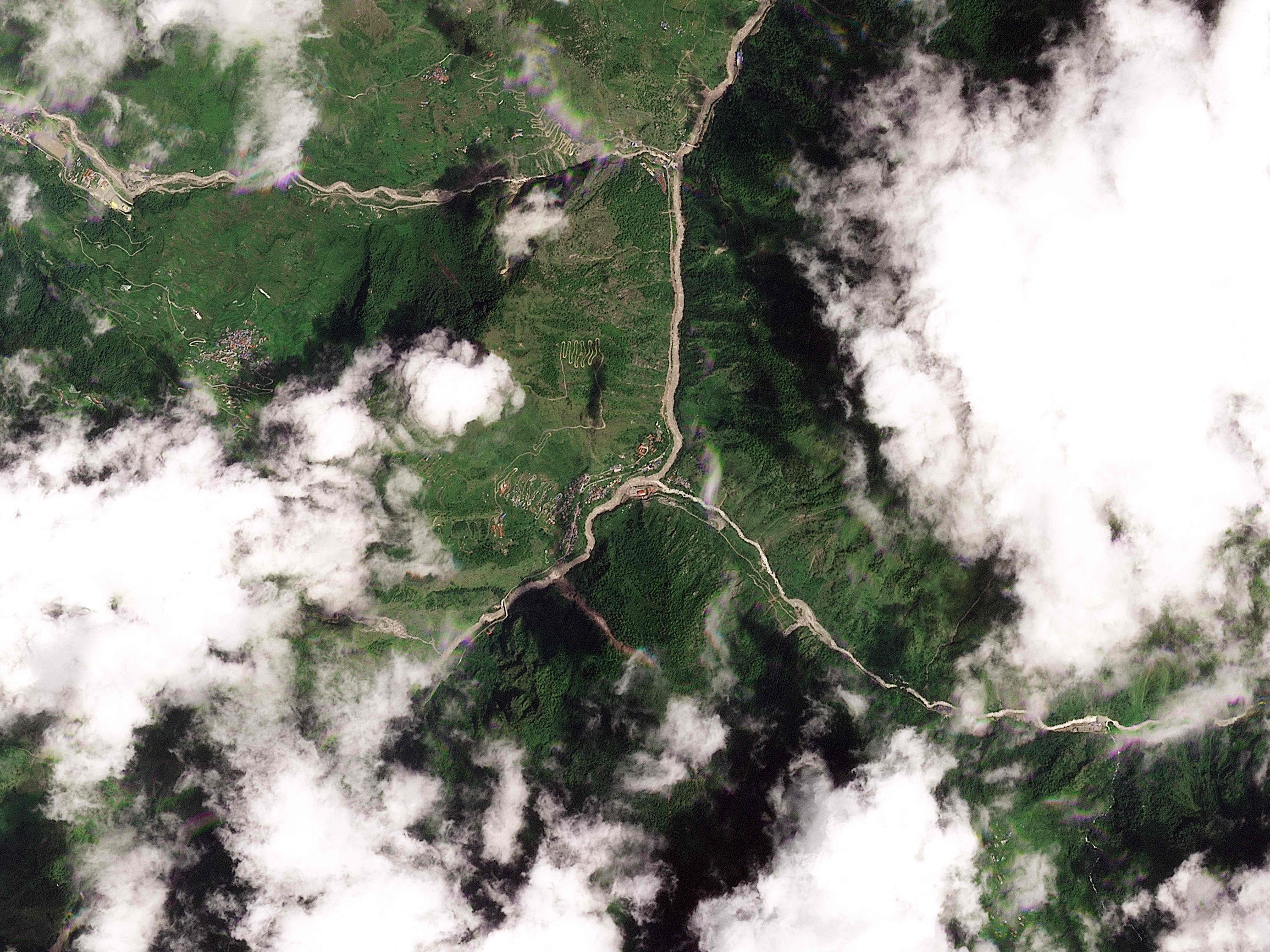
Scientists used pictures taken from space to study severe floods near Nepal’s border with China.
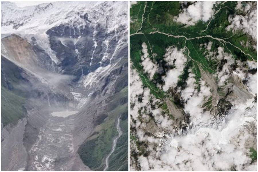
The pictures showed that part of a glacier on Langtang Lirung peak had broken off.
They also indicated that a large piece of the mountain underneath the glacier collapsed.
This created an avalanche made of ice, rocks and other debris.
The avalanche then moved downstream and contributed to the destruction.
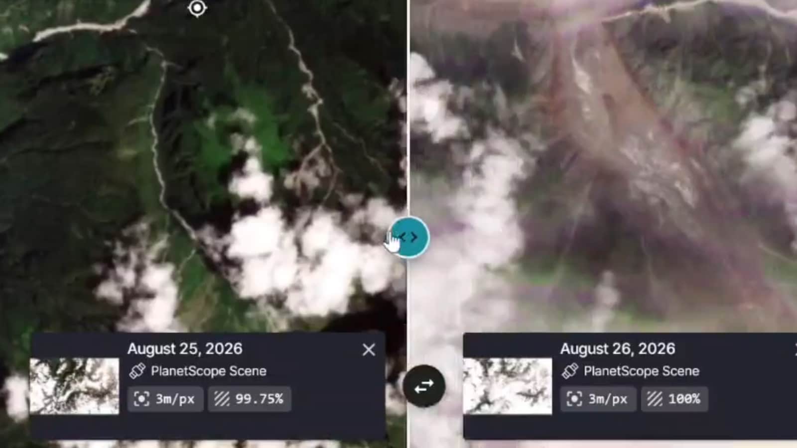
Early satellite pictures were hard to see because clouds and dust blocked the view.
Later pictures were clearer and showed more details.
Scientists Kristen Cook and Dan Shugar examined the images.
Their findings reveal more about how the disaster began.

Earth scientists used satellite images to examine catastrophic flooding along the Nepal-China border.
Clearer imagery showed that part of the glacier on Langtang Lirung peak had broken away.
Scientists said the collapse also involved a much larger section of underlying mountain bedrock.
The resulting avalanche carried ice, rock and debris downstream.
Initial images were obscured by clouds and dust, while clearer imagery was taken on Thursday.
- Who
- Earth scientists Kristen Cook and Dan Shugar reviewed satellite imagery of the disaster.
- What
- A glacier and a large section of underlying bedrock collapsed, triggering an avalanche of ice, rock and debris that swept downstream and contributed to catastrophic flooding.
- Where
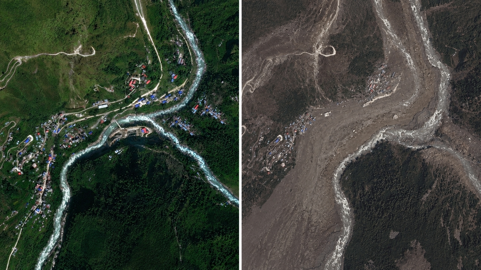
- Near Langtang Lirung peak along the Nepal-China border, including Syapru Besi in Nepal and the area near Tibet.
- When
- The clearer satellite imagery was taken on Thursday; the comparison includes images from October 18, 2023, and August 27, 2026.
- Why
- The imagery was reviewed to clarify the chain of events behind the catastrophic flooding.
Key facts
- Disaster area
- Along the Nepal-China border
- Mountain
- Langtang Lirung peak
- Main finding
- A glacier section and underlying bedrock collapsed
- Avalanche material
- Ice, rock and debris
- Affected location shown
- Syapru Besi, Nepal
- Image provider
- Vantor
- Image conditions
- Initial images were obscured by clouds and dust
Sources
Related news

Satellite Images Reveal Glacier-Linked Collapse Behind Nepal-China Floods
Satellite Images Reveal Possible Cause of Devastating Nepal Floods
Images Reveal Glacier Collapse Behind Nepal’s Deadly Flood

ISRO Images Link Nepal-Tibet Floods to Glacier Collapse
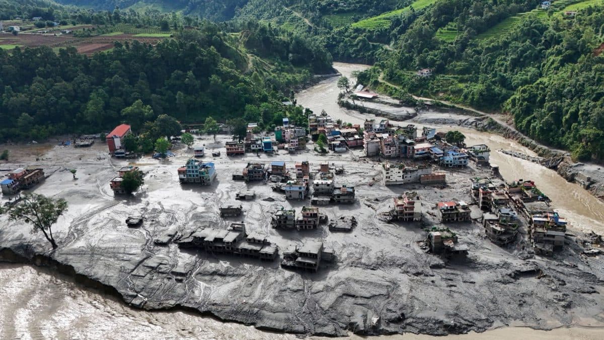
Langtang Lirung Mountainside Collapse Triggered Devastating Nepal-Tibet Flood