4 days ago
Images Reveal Glacier Collapse Behind Nepal’s Deadly Flood
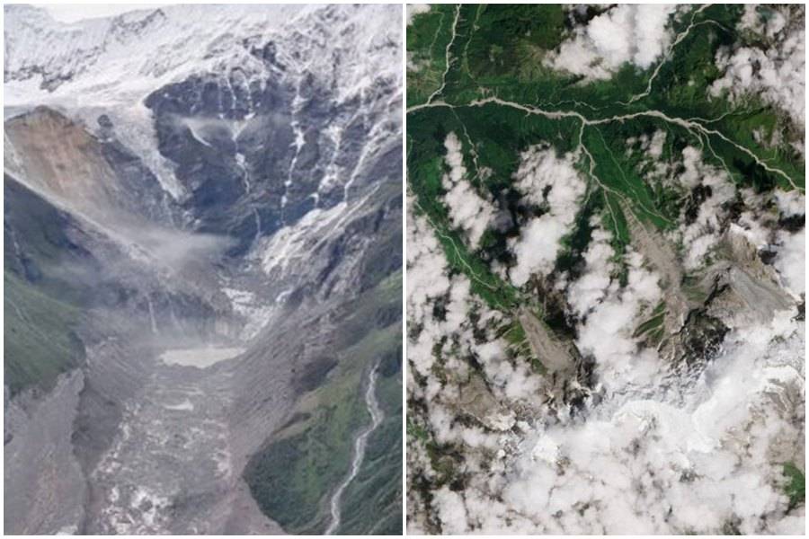
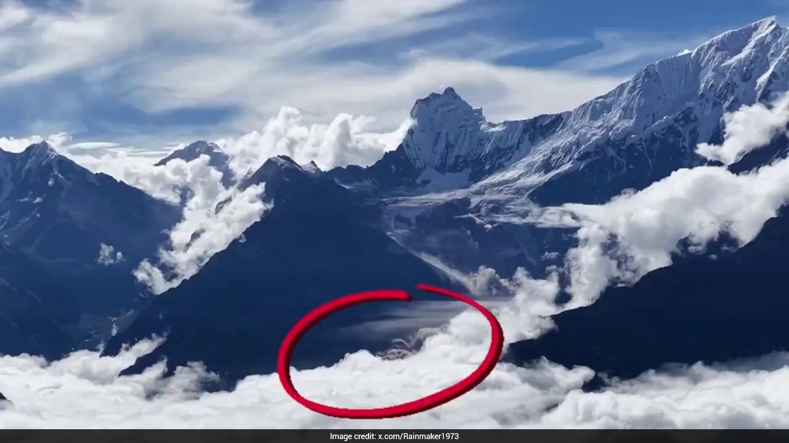
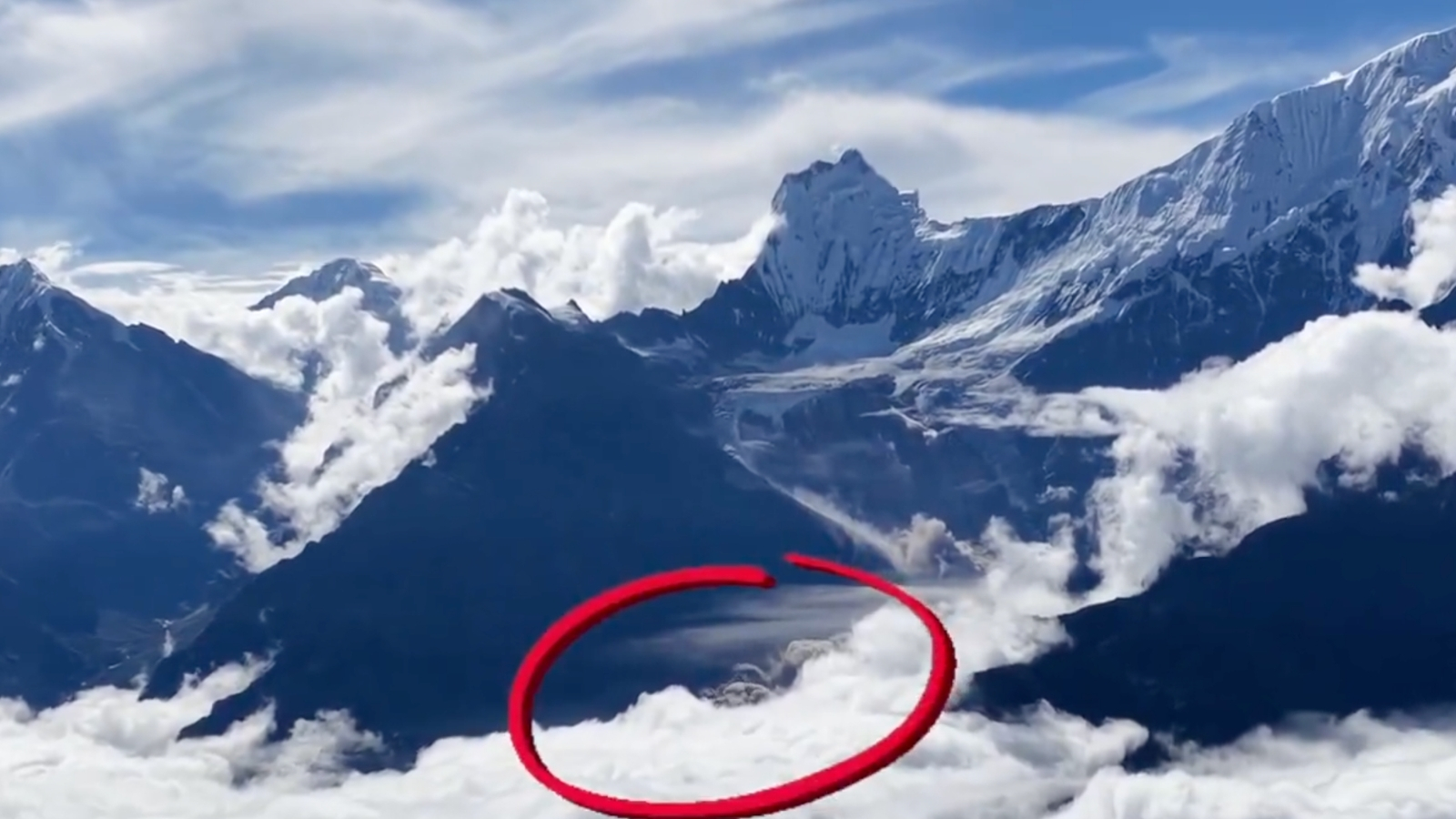
A large piece of a glacier broke away high in the mountains of Tibet.
The rock underneath it also collapsed, making the event much bigger.
Ice, snow, rocks and dirt rushed down the valley.
The debris hit the Lhende River and briefly blocked it.
When the blockage broke, a huge wave of muddy water and debris moved downstream.
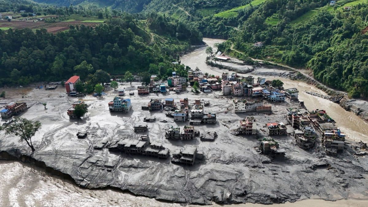
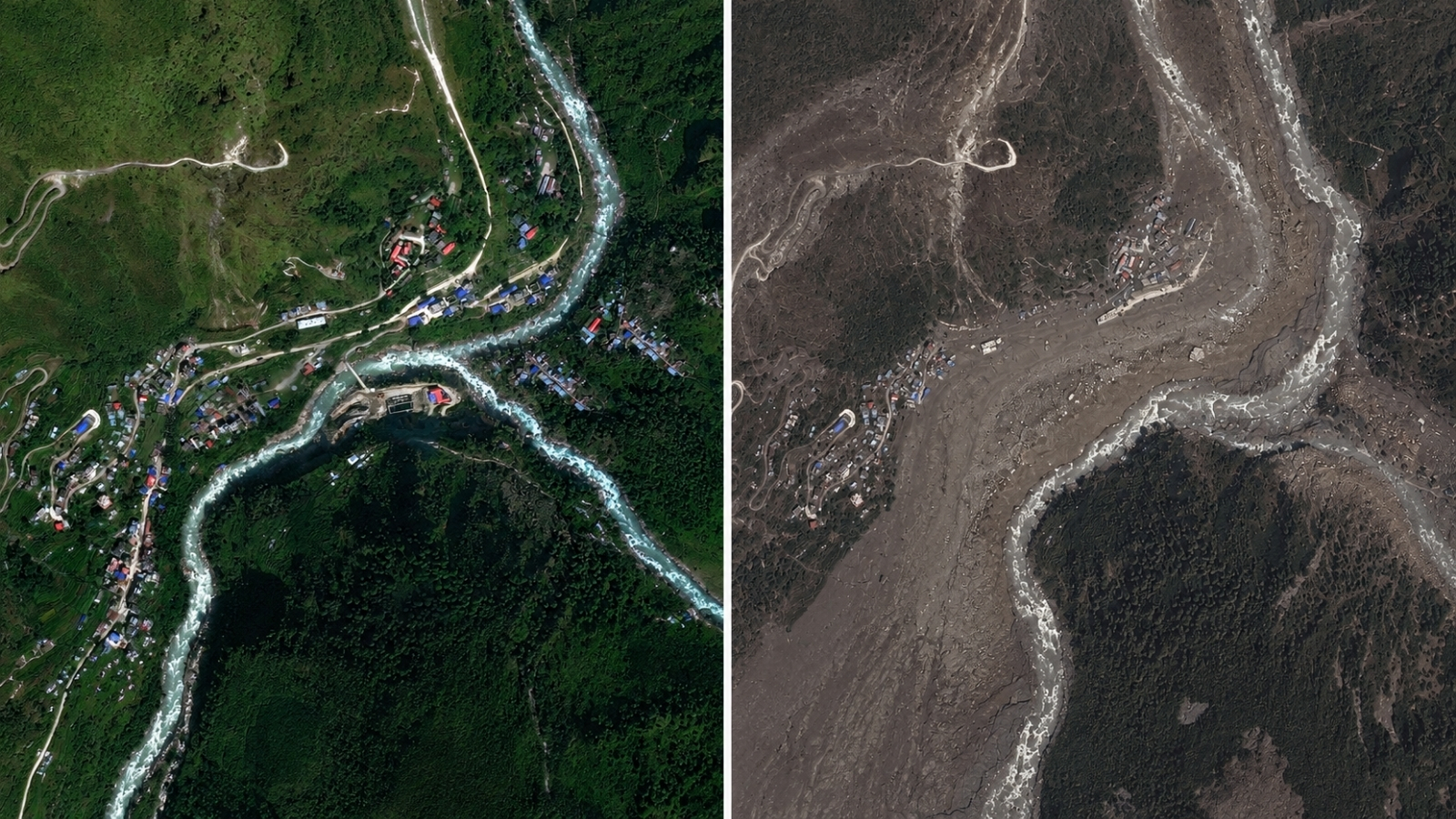
The flood crossed into Nepal and damaged towns and villages.
It destroyed roads, bridges and hydropower facilities.
The Gyirong border crossing was also overwhelmed.
The report says at least 669 people died and 2,426 people were still missing.

A glacier and part of the underlying bedrock collapsed in Tibet’s Shigatse region on August 26.
The failure sent ice, snow, rocks and sediment roughly 1,200 metres down from about 5,200 metres.
Debris briefly blocked the Lhende River before water, mud, ice and rock surged downstream.
The flood devastated Nepal’s Trishuli corridor, destroying roads, bridges and hydropower projects.
At least 669 people died in Nepal, while 2,426 remained unaccounted for, according to the report.
- Who
- Communities in Nepal were affected after a glacier and mountainside in Tibet collapsed.
- What
- A glacier-related landslide triggered a destructive debris flood.
- Where
- The collapse occurred in Tibet’s Shigatse region, near the Lhende River, and the flooding struck Nepal’s Trishuli corridor.
- When
- The glacier failure occurred on August 26; the report does not specify the year.
- Why
- Experts said a bedrock failure carried part of the glacier downhill, briefly blocking the river before the barrier gave way.
Key facts
- Origin
- A mountainside and glacier collapsed in Tibet’s Shigatse region.
- Date of collapse
- August 26; the year is not specified in the report.
- Starting elevation
- About 5,200 metres.
- Estimated descent
- Roughly 1,200 metres.
- River affected
- The Lhende River, about 20 kilometres northeast of the Nepal-China border crossing.
- Deaths in Nepal
- At least 669.
- Unaccounted for
- 2,426 people.
Quotes
Iain Cameron
British glaciologist who shared the photograph and described the apparent collapse site
“It shows the whole area without anything hidden, and we could see that, yes, it looked like there was not only this glacier that had failed, but a much larger chunk of the bedrock of the mountainside itself that had given way.”
 telegraphindia.com
“Well, there it is. The scene at the location where it all began. It looks almost like a small nuclear bomb was detonated in the valley.”
telegraphindia.com
Sources
Related news

Nepal Deluge Traced to Glacier Collapse Near Tibet
Drone Footage Shows Nepal Glacier Collapse Behind Deadly Floods
Langtang Lirung Mountainside Collapse Triggered Devastating Nepal-Tibet Flood

Satellite Images Reveal Glacier-Linked Collapse Behind Nepal-China Floods
Satellite Images Reveal Glacier Collapse Behind Nepal Border Floods
Drone Footage Reveals Glacier Collapse Behind Nepal-Tibet Floods
Nepal Plans New Landslide Warning System Along China Border

Nepal Thanks India as Glacial Disaster Rescue Efforts Continue
Nepal Warns of Heavy Rain After Deadly Floods
Nepal Flood Exposes Delayed Alerts and Cross-Border Warning Gaps

Bhotekoshi Flood Crisis: Nepal PM Shah Calls for Courage