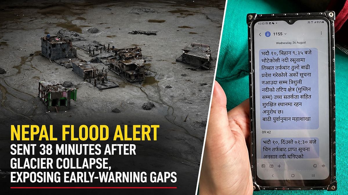
2 days ago
Langtang Lirung Mountainside Collapse Triggered Devastating Nepal-Tibet Flood
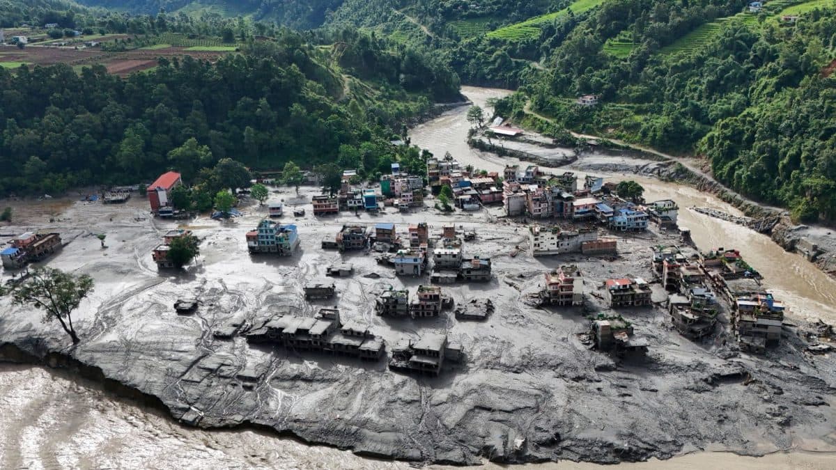
Scientists now think the flood was caused by more than a glacier breaking.
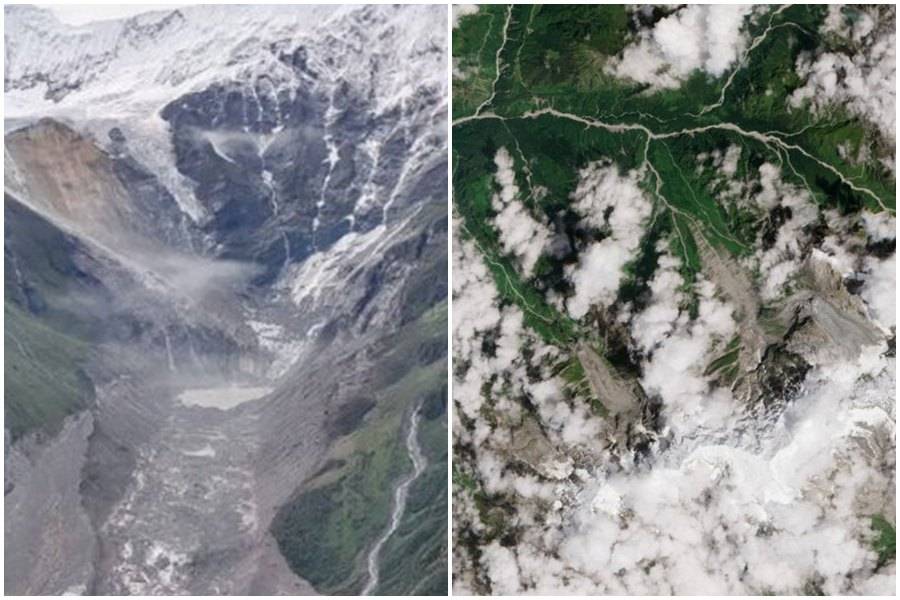
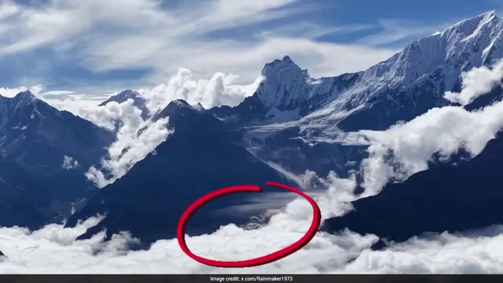
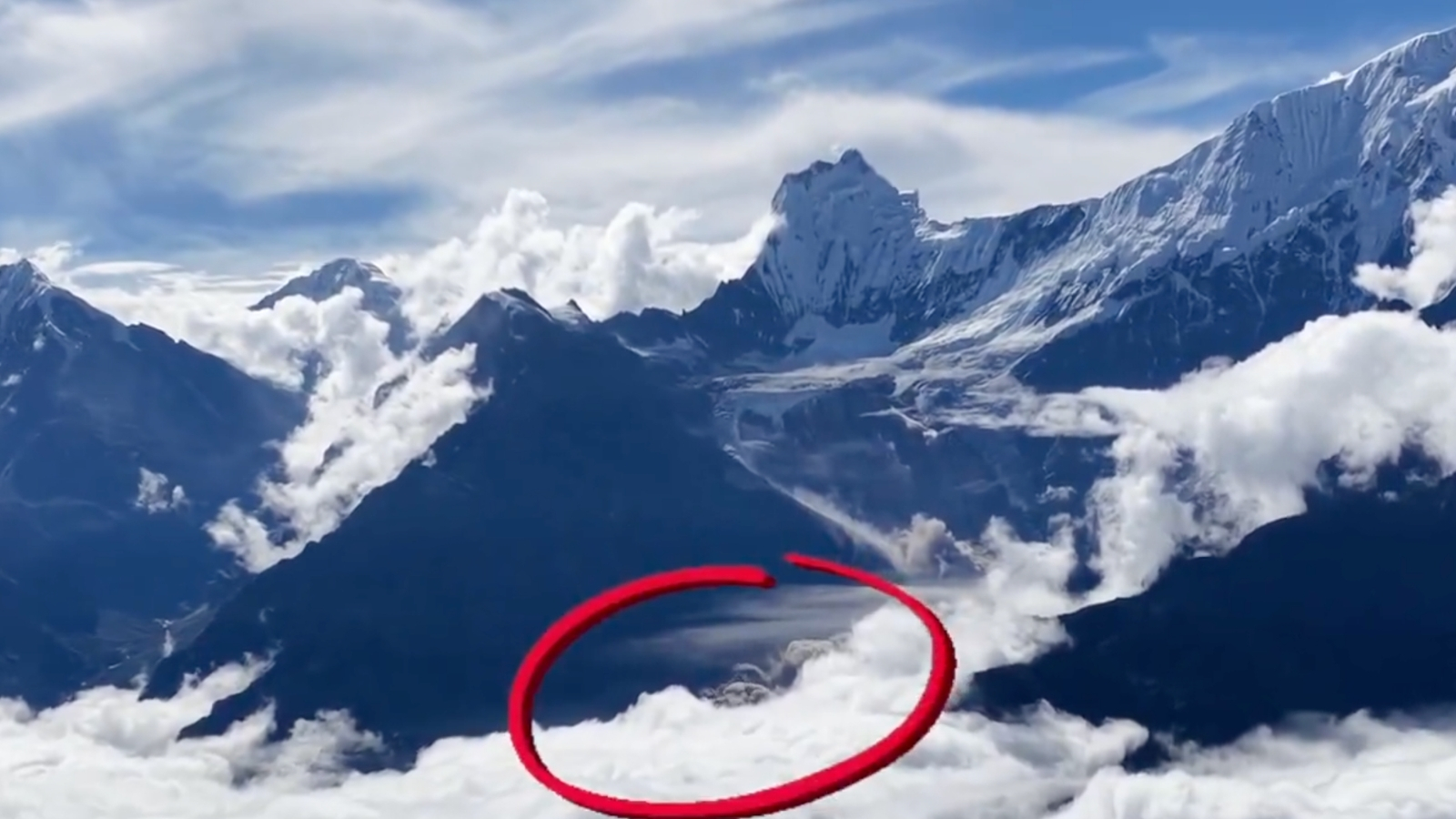
A large part of Langtang Lirung mountain in Nepal collapsed, taking some of the glacier with it.
The falling rocks and ice smashed into the valley below.
They melted and mixed with water, mud, and more rocks to create a huge debris flow.
The flow travelled through rivers toward Tibet and Nepal.
It hit the Gyirong border checkpoint on the Tibetan side before continuing downstream.
A lake formed after the flood, creating fears of another flood, but that has not happened so far.
Scientists still do not know what caused the mountainside to collapse.

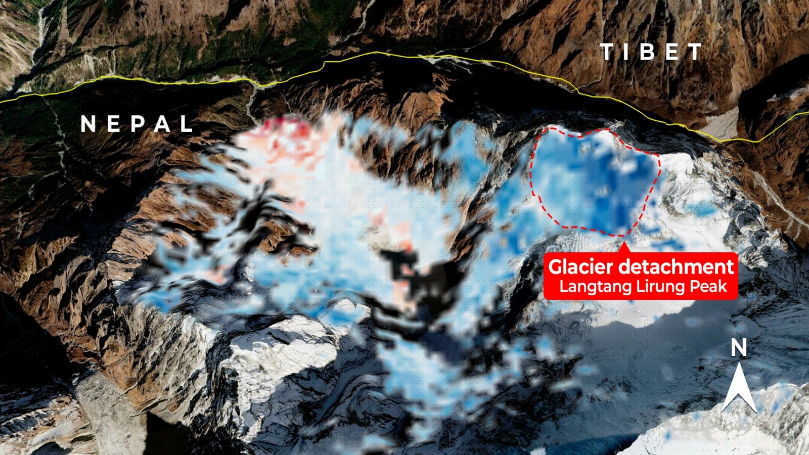
New satellite imagery indicates that a large section of Langtang Lirung’s northern face collapsed with the glacier above it.
The rock-and-ice avalanche fell roughly 1,000 metres and may have carried up to 200 million cubic metres of debris.
The resulting debris flow travelled through the Lhende Khola and Bhote Koshi river systems, striking Tibet before reaching Nepal.
The disaster began on the Nepali side, although the transboundary river system affected both Nepal and Tibet.
The cause of the mountainside collapse remains unknown, and officials have not confirmed whether one or multiple barrier lakes formed.
- Who
- The collapse involved Langtang Lirung in Nepal and affected areas along the Lhende Khola and Bhote Koshi river systems, including Tibet and Nepal.
- What
- A mountainside and part of the glacier above it collapsed, producing a rock-and-ice avalanche, debris flow, and flash flood.
- Where
- The collapse originated on the northern face of Langtang Lirung in Nepal near the Nepal-Tibet border, with impacts in Tibet and downstream Nepal.
- When
- The disaster occurred last week; satellite imagery cited in the report includes an image dated August 12, 2026.
- Why
- The precise cause of the mountainside collapse remains unknown. An earthquake was initially considered but was later ruled out by the US Geological Survey.
Initial Interpretation
Updated Analysis
What caused the flood
Initial Interpretation
Early accounts attributed the disaster mainly to a glacial collapse.
Updated Analysis
Clearer satellite imagery indicates that a large mountainside failure carried part of the glacier down with it, creating the avalanche and debris flow.
Possible earthquake trigger
Initial Interpretation
An earthquake was initially suggested as a possible trigger after seismic activity was detected.
Updated Analysis
The US Geological Survey later said there had been no earthquake and that the seismic activity was caused by the collapse and subsequent debris flow.
Location of the barrier lake
Initial Interpretation
The lake was initially understood to be on the Tibetan side of the border.
Updated Analysis
Coordinates from Suhora Technologies placed the monitored lake inside Nepal, although it remained unclear whether a reported Tibetan dam breach involved the same lake or another one.
Key facts
- Mountain
- Langtang Lirung is 7,234 metres high.
- Collapse elevation
- Analysts estimate the failed section was at about 5,000 metres.
- Estimated debris
- The rock-and-ice avalanche may have carried up to 200 million cubic metres of debris.
- River route
- The debris travelled through the Lhende Khola and then the Bhote Koshi river system.
- Barrier lake
- Suhora Technologies estimated the newly formed lake at 20 hectares before reports of a possible breach.
- Seismic activity
- The US Geological Survey said there was no earthquake; the recorded 5.2-magnitude seismic activity was generated by the collapse and debris flow.
Quotes
Y Nithiyanandam
Head of the Geospatial Programme at the Takshashila Institution
“We cannot answer why the mountainside collapsed with the facts that we currently have. For now, we can only address the question of what most likely happened.”
 firstpost.com
Sources
Related news
Images Reveal Glacier Collapse Behind Nepal’s Deadly Flood

Nepal Flood May Have Begun With Border Ice Avalanche
Drone Footage Shows Nepal Glacier Collapse Behind Deadly Floods
Drone Footage Reveals Glacier Collapse Behind Nepal-Tibet Floods

Nepal Deluge Traced to Glacier Collapse Near Tibet

Satellite Images Reveal Glacier-Linked Collapse Behind Nepal-China Floods

Nepal Flood Death Toll Tops 1,200 as Searches Continue
Satellite Radar May Strengthen Nepal's Flood Warning Systems
Nepal Plans New Landslide Warning System Along China Border

Nepal Thanks India as Glacial Disaster Rescue Efforts Continue
Nepal Warns of Heavy Rain After Deadly Floods