1 week ago
Delhi's Erratic Weather Brings Heavy Rain, Thunderstorms And Relief
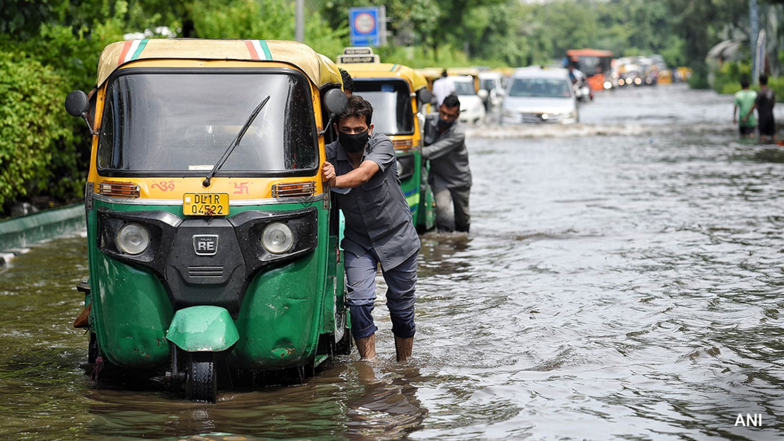
Delhi-NCR had heavy rain and thunderstorms on Monday.
Janakpuri received the most rain, measuring 67 millimetres.
The rain caused waterlogging and slow traffic in several places.
Weather officials warned that more rain, lightning and strong winds were possible.
They said dry winds from the north met wet winds coming from the Bay of Bengal.
This meeting of air masses helped produce intense storms.
The rain also lowered temperatures and gave people some relief from heat and humidity.
This year's monsoon has been uneven, with long dry periods followed by sudden heavy rain.
The weather office expects partly cloudy skies and mostly normal temperatures over the next two days.

Delhi-NCR received heavy rainfall on Monday, with Janakpuri recording the highest total at 67 mm.
The India Meteorological Department issued a three-hour Red Alert, followed by an Orange Alert for the rest of the day.
The IMD warned of thunderstorms, lightning, winds of around 60 km/h and rainfall exceeding 15 mm per hour.
Waterlogging disrupted normal life and slowed traffic across several parts of Delhi-NCR.
The IMD attributed the intense rain to the interaction of dry northerly winds and moisture-laden easterly winds from the Bay of Bengal.
- Who
- Residents and commuters in Delhi-NCR were affected; the India Meteorological Department issued the warnings, and IMD scientist Dr Shashikant explained the causes.
- What
- Heavy rainfall, thunderstorms and strong winds affected Delhi-NCR, causing waterlogging and traffic disruption.
- Where
- Delhi-NCR, including Janakpuri, Chhatarpur, Faridabad, Gurugram, Pitampura and Safdarjung.
- When
- Monday; the forecast covers August 25 and August 26, 2026.
- Why
- The IMD said dry northerly winds interacted with moisture-laden easterly winds associated with a low-pressure area near West Bengal.
Key facts
- Highest rainfall
- Janakpuri recorded 67 mm by 1:15 pm.
- Second-highest rainfall
- Gurugram recorded 52 mm by 1:15 pm.
- Weather alerts
- The IMD issued a three-hour Red Alert and an Orange Alert for the rest of the day.
- Severe-weather risk
- Thunderstorms, lightning, winds around 60 km/h and rainfall exceeding 15 mm per hour were forecast in several Delhi districts.
- Monsoon arrival
- The southwest monsoon reached Delhi on July 2, 2026, five days later than the usual June 27 date.
- August 25 forecast
- Temperatures were expected to range from 33–35°C during the day and 25–27°C at night, with possible very light afternoon rain.
- August 26 forecast
- Temperatures were expected to range from 34–36°C during the day and 25–27°C at night, with partly cloudy skies.
Quotes
Dr Shashikant
Scientist at the India Meteorological Department
“There are two main reasons for today's intense rainfall.”
 NDTV
NDTV
Sources
Related news

Delhi Faces Heavy Rain for Second Day, Red Alert Issued
Heavy Rain In Delhi-NCR, More Showers Forecast Till August 14

Delhi Records Wettest First Week of August in 15 Years

Delhi's Wettest August Day in Two Years Brings Heavy Rain, Waterlogging

Heavy Rain Hits Delhi-NCR as IMD Issues Red Alert

IMD forecasts Delhi-NCR rainfall until August 16 amid monsoon surge

Sharma and Malik share halfway lead at Telangana Golconda Masters

Gurgaon CEO’s Sleep Debate Challenges India’s Early-Rising Expectations

Gurugram Fake Call Centre Targeting US Citizens Busted, 11 Arrested

Sheoran And Sharma Share Course-Record Lead At Golconda Masters

POWERGRID AGM Highlights Network Growth and Technology Plans