3 weeks ago
Why Assam floods every monsoon, what is different this year
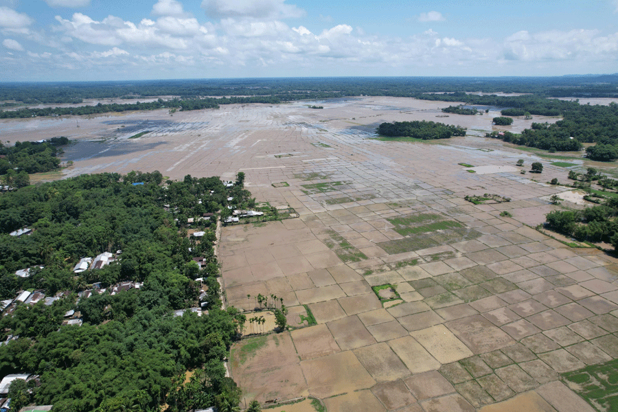
Every year during the rainy season, the big Brahmaputra River in Assam, India, overflows and floods the land.
This year the floods were much worse than usual, and they hit places that are not used to them.
More than 200,000 people were affected, and sadly at least 100 people died.
Thousands of villages were covered in water, and many families had to move to relief camps.
The water came very fast — one teacher said his house filled with water in just 20 minutes.
Very heavy rain, much more than normal, made the rivers swell.
But scientists say human actions, like digging for coal and sand and building on flood lands, made things worse.
Officials first said a sudden storm in a neighbouring state caused it, but they later took that back.
Experts believe early warnings, given two to three days ahead, could help families escape and save lives.

At least 200,000 people have been affected and at least 100 have died in this year's Assam floods, with more than 2,000 villages submerged.
Unlike past floods, this year's disaster struck the south bank of the Brahmaputra in Upper Assam with unusual force, catching residents off guard.
Golaghat was the hardest-hit district with nearly 70,000 residents affected, followed by Sivasagar (about 55,000) and Jorhat (more than 16,000).
State authorities initially blamed a cloudburst in Nagaland but withdrew the claim after the India Meteorological Department said no cloudburst had occurred there.
Experts say extreme rainfall, up to 500% above seasonal averages, combined with coal mining, riverbed extraction, breached embankments and floodplain development to worsen the floods.
- Who
- More than 200,000 residents of Assam, including communities in Golaghat, Sivasagar and Jorhat, along with officials, scientists and relief workers.
- What
- Severe monsoon flooding that submerged more than 2,000 villages, killed at least 100 people and displaced tens of thousands.
- Where
- Assam, especially the south bank of the Brahmaputra in Upper Assam, and Nagaland's Mon district.
- When
- This year's monsoon season; floodwaters entered homes in Sivasagar shortly after 5:30pm on July 19.
- Why
- Extraordinary rainfall (up to 500% above normal) combined with human factors such as coal mining, riverbed extraction, breached embankments and floodplain development.
Officials and natural-disaster explanation
Residents and experts' man-made factors view
Cause of the flooding
Officials and natural-disaster explanation
State authorities initially attributed the disaster to a cloudburst in neighbouring Nagaland, though they later withdrew the claim after the IMD reported no cloudburst occurred there.
Residents and experts' man-made factors view
Residents and scientists say rainfall alone cannot explain the scale, describing the floods as a 'man-made accident' caused by coal mining, riverbed extraction, breached embankments and floodplain construction.
Role of coal mining
Officials and natural-disaster explanation
Wenyei Konyak, deputy commissioner of Nagaland's Mon district, rejected suggestions that mining activity alone could account for the scale of the flooding.
Residents and experts' man-made factors view
Environmental researcher Dr Partha Jyoti Das and other experts point to runoff from open-cast coal mining, silt and sand extraction as factors that made floods more intense and less predictable.
Living with floods vs. prevention
Officials and natural-disaster explanation
Historical view: floods are woven into life in Assam — in 2004 then Chief Minister Tarun Gogoi said people would have to learn to live with them.
Residents and experts' man-made factors view
Affected residents and experts question whether institutions such as the Brahmaputra Board have done enough, calling for better early warning systems, monitoring networks and community-centred alerts.
Key facts
- People affected
- At least 200,000
- Deaths
- At least 100 in Assam; at least 11 in Nagaland's Mon district
- Villages submerged
- More than 2,000; at least one completely washed away
- Cropland underwater
- At least 17,000 hectares
- People in relief camps
- At least 49,000 across 125 camps
- Hardest-hit districts
- Golaghat (~70,000), Sivasagar (~55,000), Jorhat (>16,000)
- Rainfall anomaly
- Up to 500% above seasonal average in parts of Assam; 435–490% above normal in Nagaland
- Embankments breached
- At least 18 before floodwaters peaked
Quotes
Dr Partha Jyoti Das
Environmental scientist studying Assam’s river systems
“"Their greatest strength is simple: time. A reliable warning issued even 48 to 72 hours before a flood can allow families to move livestock, protect belongings, evacuate vulnerable people, and save lives."”
 telegraphindia.com
“"The overall degradation of hill ecology has increased the destructive power of floods."”
telegraphindia.com
Sources
Related news
Assam rebuilds after floods kill 97, displace 12 lakh
Assam's July Floods: More Than Just the Brahmaputra

Assam Floods Kill At Least 100 Amid Monsoon Deluge
Upper Assam's Flood Catastrophe Blamed on River and Mountain Grabbing

Assam's Golaghat district hit by drought followed by devastating floods
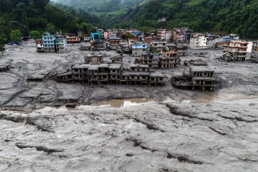
Nepal and Upper Assam Disasters Expose Climate Risks

Northeast Weaves Take Center Stage at Delhi Fashion Week

GST Collection Rises Nearly 15% To About Rs 2 Lakh

Nagaland Assembly Tables Revised Frontier Territorial Authority Bill

Delhi Fashion Week Showcases Khadi and Northeast India’s Heritage