1 week ago
Possible Super El Niño Could Reshape 2026–27 Weather Patterns
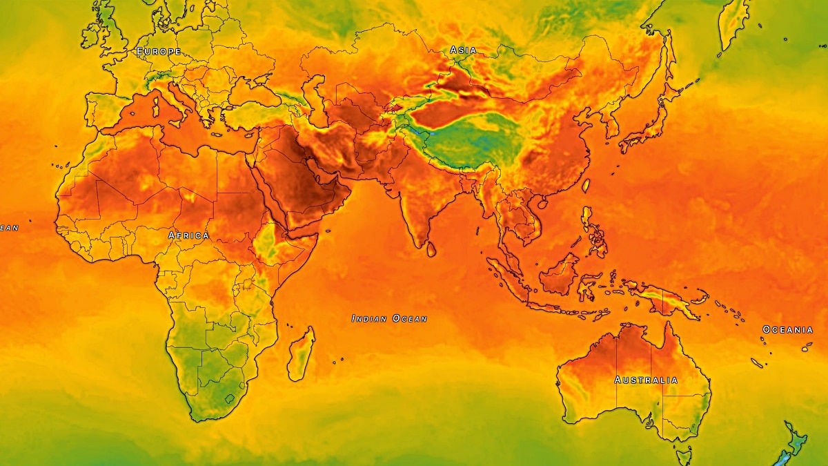
El Niño is a recurring climate pattern that starts in the tropical Pacific Ocean.
During it, warm ocean water moves east and changes rainfall and winds around the world.
Forecasts suggest the 2026–27 event could be unusually strong.
Scientists think it might become stronger than the 2015–16 record in one important Pacific measurement.
In India, it could mean more heat early in the year and a weaker summer monsoon later.
Other places could become drier, while some regions could receive heavier rain and floods.
El Niño can also change where tropical storms form.
It can briefly make the world warmer by releasing ocean heat into the air.
Human-caused greenhouse-gas emissions, not El Niño, remain the main cause of long-term global warming.

Forecasts suggest the 2026–27 El Niño could exceed the previous Niño 3.4 record of 2.75°C.
A strong El Niño can weaken India’s summer monsoon and increase early-year heat and later drought risks.
The event could bring drier conditions to Southeast Asia, Australia, parts of Africa and tropical South America.
El Niño may raise global temperatures temporarily but is not the underlying cause of long-term global warming.
The term “super El Niño” is informal, and forecasts remain subject to change because other climate factors also matter.
- Who
- Scientists and climate forecast models are assessing the possible 2026–27 El Niño and its effects on regions including India.
- What
- A potentially exceptionally strong El Niño could influence monsoons, global temperatures, rainfall, drought, flooding and tropical storms.
- Where
- It develops in the tropical Pacific Ocean and may affect India and weather patterns worldwide.
- When
- The forecast event is expected to affect weather through 2026 and into 2027.
- Why
- Forecasts suggest Niño 3.4 sea-surface temperatures could exceed the previous 2.75°C record from 2015–16.
Key facts
- Climate pattern
- El Niño is the warm phase of the El Niño–Southern Oscillation, which also includes La Niña and neutral conditions.
- Typical duration
- El Niño and La Niña generally last nine to 12 months, though some events persist longer.
- Potential intensity
- Forecasts indicate the Niño 3.4 sea-surface temperature anomaly could surpass 2.75°C.
- Previous record
- The 2.75°C Niño 3.4 record was set during the 2015–16 El Niño.
- India risk
- El Niño can contribute to early-year heat, weaken the summer monsoon and raise drought risks in India.
- Global temperature effect
- A 1°C change in the Niño 3.4 region is broadly associated with about a 0.1°C change in global average temperature, after roughly three to six months.
- Scientific terminology
- “Super El Niño” is not a formal scientific classification.
Sources
Related news
Potential 2026 Super El Niño Could Rewrite Global Weather Records

Strong El Niño Threatens India’s Monsoon, Raises 2027 Heat Risk

Powerful El Niño Could Make 2027 Hottest Year
Historic El Niño to develop by year-end, US agency says
Powerful El Niño Could Make 2027 Hottest Year

Record-Strength El Niño Could Bring Extreme Global Weather

From Magic Squares to Memorable Ads, Signs and Slogans

Maharashtra, Australia Plan Biomanufacturing Task Force for Joint Growth

India Replaces Sri Lanka as 2027 Women’s Champions Trophy Host

Mitsubishi Revives Pajero With 201PS Fifth-Generation SUV

IIM-Born CEO Says Australia’s Everyday Life Runs on Trust