

Science & Tech · Science & Environment · 1 hr ago
Satellite Data Reveal Opposing Changes Beneath Nicaragua’s Masaya Volcano
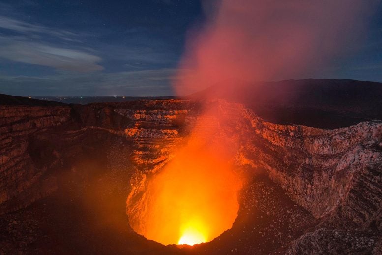
Researchers tracked ground movement beneath Masaya Volcano in Nicaragua using satellite radar measurements from 2018 to 2024.
The ground in the volcano’s caldera first sank and then rose, while the area around the active Santiago crater continued to sink.
The opposing movements suggest separate magma reservoirs are changing independently: the main reservoir may be filling, while a shallower one may be losing magma.
These are interpretations of surface movement, and the connections between the underground reservoirs remain poorly understood.
The findings could help improve monitoring of Masaya and other volcanoes with lava lakes.
Sulfur dioxide emissions already pose a hazard at Masaya, but the study found no immediate danger to nearby communities from the changes it examined.
Researchers say longer-term tracking and further modeling could clarify how magma moves beneath the volcano.

Satellite measurements show that different parts of Nicaragua’s Masaya volcano moved in opposite directions between 2018 and 2024.
The ground in Masaya’s caldera first sank and then rose, while the surface around the active Santiago crater continued to sink.
Researchers say the pattern may mean a main magma reservoir was expanding as a shallower reservoir lost magma.
The study’s authors did not identify an immediate danger to nearby communities from the changes they examined.
About 2 million people live within 13 miles (21 kilometers) of the active volcano, which also emits sulfur dioxide.
- Who
- Penn State researchers, including lead author Lizzie Johnson, studied the volcano’s ground movements.
- What
- Satellite data showed the caldera sinking and then rising while the area around Santiago crater kept sinking.
- When
- Between 2018 and 2024.
- Where
- Masaya Volcano in Nicaragua.
- Why
- The researchers said the pattern may reflect changes in separate magma reservoirs; the observations could help improve volcano monitoring.
This story does not have two clearly opposing sides.
Sentinel-1 satellite measurements tracked ground movements at Masaya.
The caldera initially sank and then began rising, while the surface around Santiago crater continued to sink.
- Study period
- 2018–2024
- Satellite
- Sentinel-1, passing over Masaya about once every 12 days
- Caldera movement
- Initially sank, then began rising
- Santiago crater area
- Continued sinking throughout the study
- Nearby population
- About 2 million people within 13 miles (21 kilometers) of the volcano
- Last major lava flow
- 1772
What people are saying
At the same time, the area directly around the active Santiago crater deflated over the entire study period independently of the transition to inflation of the main reservoir
Sources
Related news

High-speed video shows how detached honeybee stingers keep pumping venom

Wolves Reduced Yellowstone Elk, but Tree Recovery Stayed Limited

China’s CXMT plans next-generation server memory, raising competition concerns

Trump revives effort to halt Ørsted offshore wind farm construction

Scientists urge governments to tighten rules on the exotic pet trade

Quantum simulator reveals predicted energy patterns at two tipping points
Egyptian fossils identified as a new 45-million-year-old crocodile species

Pacific buoy recorded a 17.6-metre rogue wave nearly three times its neighbours

A 1960 population model set a ‘doomsday’ date that later growth disproved
Red dwarf slowly draws matter from a brown dwarf

Vellore starts clearing invasive plants from irrigation tanks before monsoon
