

1 week ago
Gurugram Flooding Demands Hydrological Planning, Not Just Bigger Drains
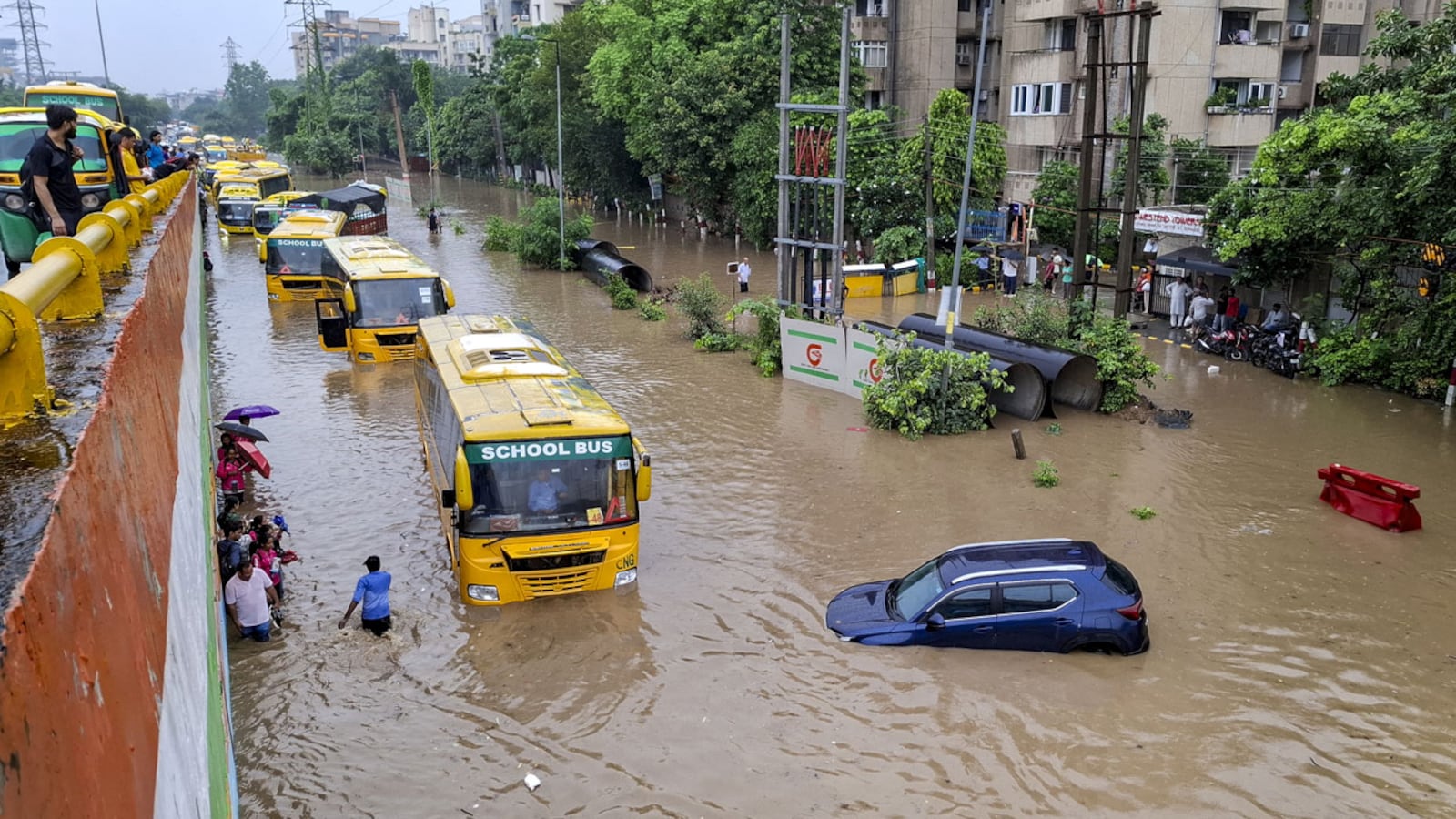
Gurugram often floods when heavy rain falls because the city has built over places that once absorbed or stored water.
Rainwater follows the land’s natural slopes, not the city’s sector boundaries.
Concrete roads and buildings make more water run off quickly.
This can overwhelm drains, even when those drains are large.
The article says the city should keep more rainwater near where it falls.
Ponds, wetlands, plants, permeable pavements and storage areas can slow down and absorb water.
New buildings should be checked to see how much extra water they create.
The goal is to let the landscape help manage rain instead of relying only on emergency pumping and bigger drains.

Gurugram’s recurring floods are described as a planning failure that ignores the city’s natural slopes, drainage channels and water-storage areas.
Urbanisation has replaced permeable land with concrete, increasing the speed and volume of stormwater runoff.
A GIS and SWMM-based study found that green roofs, permeable pavements and rainwater storage could reduce runoff volume by up to 72.31%.
The article recommends restoring ponds, wetlands, natural drains and other blue-green infrastructure alongside conventional drainage systems.
Future development approvals should assess catchments, added impervious surfaces, runoff, flood pathways and performance under more intense rainfall.
- Who
- Gurugram’s planners, developers, infrastructure agencies and municipal authorities are identified as responsible for improving stormwater management.
- What
- The article argues that recurring flooding results from inadequate hydrological planning, urbanisation and the loss of natural drainage and storage systems.
- Where
- Gurugram, in the urban region shaped by the Aravallis and draining toward the Najafgarh system.
- When
- The problem recurs every monsoon, and the article calls for long-term planning before future development and rainfall events.
- Why
- Impervious development increases rapid runoff, while natural drains, ponds, depressions and recharge areas have been obscured or encroached upon; more intense rainfall may further increase the risk.
Key facts
- Natural elevation difference
- The article cites an elevation difference of roughly 60 to 70 metres between the Aravalli foothills and the Najafgarh basin.
- Study area
- A GIS and SWMM-based study examined eight high-runoff sub-catchments in Gurugram.
- Potential runoff reduction
- Green roofs, permeable pavements and rainwater storage were found capable of reducing runoff volume by as much as 72.31%.
- Potential peak-discharge reduction
- The same measures could reduce peak discharge by up to 54.05%.
- Preferred management hierarchy
- The article proposes: retain, infiltrate, reuse, convey and discharge.
- Recommended planning tools
- Catchment-level modelling, high-resolution Digital Elevation Models, rainfall data, soil information, land-use data and EPA-SWMM simulations are recommended.
Sources
Related news
Why Gurugram Submerges Every Monsoon Despite Drainage Spending

India's Cities Face Flooding as Rainfall Intensifies and Infrastructure Lags
Why Gurugram’s Wealthiest Corridor Flooded Despite Drainage Upgrades

Gurugram Flooding Blamed on Growth as MPs Promise 2047 Fix

Gurgaon Pitches Underground Wells and Tanks to Fight Flooding

Delhi NCR floods: why can't Indian cities handle monsoon rain?

Delhi’s 2047 Plan Balances Development, Ecology and Heritage

Aravalli Mining Leaves Rajasthan Villages Facing Water Crisis
Leopard panic grips Gurugram hamlet after three calves killed
Mining Leaves Cracks, Dust and Displacement Across Rajasthan’s Aravallis

HAL, Safran Sign Deal for India’s Aravalli Helicopter Engine