3 hrs ago
Growing Himalayan Glacial Lakes Threaten India’s Hill Towns
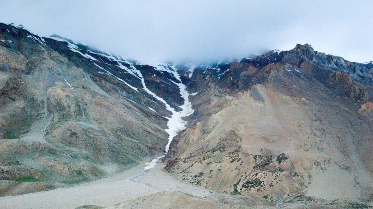
Glacial lakes form when glaciers melt and leave pools of water behind.
Some lakes are held back by piles of loose rocks and ice called moraines.
If those barriers break, a sudden flood called a glacial lake outburst flood can rush down the valleys.
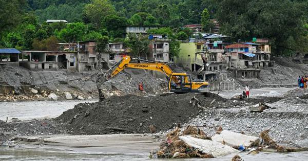
The flood may carry water, ice, rocks and mud, damaging roads, bridges, homes and dams.
In October 2023, South Lhonak Lake in Sikkim caused a major flood that reached far downstream.
Scientists say the danger depends not only on the lake, but also on what people and buildings are in the flood’s path.
It is difficult to know exactly when a lake will break or how big the flood will become.
India is working on sensors, warnings, modelling and evacuation plans, but many high mountain areas are difficult to monitor.

A 2023 collapse at South Lhonak Lake triggered a flood that traveled up to 385 kilometers downstream and destroyed the Teesta III hydropower project.
A 2025 assessment found that Sikkim’s glacial lakes increased from 309 to 440 between 1990 and 2020, while their combined area expanded from 22.83 to 30.71 square kilometers.
Across the Indian Himalayas, 23 of 329 assessed lakes were classified as very high risk and 50 as high risk in a 2020 assessment.
Experts warn that avalanches, unstable moraines, landslides and sediment can turn a lake failure into a larger, harder-to-predict flood cascade.
India is expanding lake monitoring, downstream modelling, early-warning systems and mitigation programmes, but remote locations and limited real-time coverage remain major challenges.
- Who
- Communities, infrastructure and authorities in the Indian Himalayas are affected; researchers and agencies including the National Disaster Management Authority are working on risk reduction.
- What
- Growing and potentially unstable glacial lakes are creating risks of glacial lake outburst floods and cascading downstream hazards.
- Where
- The risks affect Himalayan basins including Sikkim’s Teesta basin, the Chenab and Jhelum basins, and the Chenab and Beas basins; impacts can extend far downstream.
- When
- The major South Lhonak Lake disaster occurred on October 3, 2023; lake changes in Sikkim were assessed using imagery from 1990, 2000, 2010 and 2020.
- Why
- Glacier retreat is increasing the number and size of some lakes, while unstable moraines, avalanches, landslides, downstream development and exposed infrastructure can magnify the damage.
Limits and uncertainty
Monitoring and intervention
Predicting flood timing
Limits and uncertainty
Researchers say the existence of a dangerous lake does not show when a GLOF will happen, and some lakes may never fail.
Monitoring and intervention
Experts and government agencies argue that sensors, satellite monitoring and actionable warning systems can provide time for evacuation and mitigation.
How to prioritize risk
Limits and uncertainty
Some assessments focus on identifying hazardous lakes, but experts warn that hazard alone does not establish downstream risk without considering exposed people and infrastructure.
Monitoring and intervention
Researchers advocate treating lakes, downstream communities, roads, hydropower plants and dams as connected systems through comprehensive downstream modelling.
Current preparedness
Limits and uncertainty
The South Lhonak Lake was reportedly recognized as high-risk before 2023, yet it lacked real-time monitoring and early-warning infrastructure before the breach.
Monitoring and intervention
Authorities are now installing monitoring systems, conducting field investigations and developing early-warning and mitigation programmes in Sikkim and other Himalayan states.
Key facts
- South Lhonak flood
- A moraine collapse generated an approximately 20-metre wave and released about 50 million cubic metres of water.
- Downstream reach
- The 2023 flood affected areas up to 385 kilometers downstream.
- Indian Himalayan assessment
- Of 329 lakes assessed in 2020, 23 were at very high risk and 50 at high risk.
- Sikkim lake growth
- The number of lakes rose from 309 to 440 between 1990 and 2020; combined area grew from 22.83 to 30.71 square kilometers.
- Sikkim risk assessment
- A 2025 assessment identified 51 lakes susceptible to GLOFs, including seven highly hazardous and six high-risk lakes.
- Government programme
- The National GLOF Risk Mitigation Programme covers Arunachal Pradesh, Himachal Pradesh, Sikkim and Uttarakhand.
- Dam regulation
- The Central Water Commission decided to review design floods for dams vulnerable to GLOFs, and GLOF studies are mandatory for certain new dams.
Quotes
Prateek Gantayat
Glacier hydrologist and high-mountain hazards researcher and modeller
“The central challenge is the gap between hazard identification — which is improving through satellite and GIS-based inventories — and actual on-ground monitoring and early-warning capacity, particularly in remote, high-altitude, and cross-border basins.”
 firstpost.com
“The hazard is the glacial lake, which is there up in the mountains. As glaciers retreat, the number of lakes is growing, and the lakes are also growing in volume. That is not something we can control.”
firstpost.com
Sources
Related news
Sikkim Identifies 40 High-Hazard Glacial Lakes, 16 Highest-Risk

Nepal Glacier Disaster Exposes India’s Himalayan Risk-Planning Challenge

Nepal’s Glacial Lakes Raise Alarms Along Vulnerable River Corridors

Nepal Disaster Prompts Call for Integrated Himalayan Hazard Assessments
Nepal Floods Expose Himalayan Risks From Warming and Development
Indian-German Climber, Sherpa Guide Killed on Manaslu
Himalayan Glacier Loss Signals India’s Looming Water Crisis

Delhi CM Rekha Gupta Joins Haritalika Teej Mahotsav
Nepal Flood Search Continues as Repairs and Identification Struggle