5 days ago
Satellite Images Show Nepal Towns Buried After Flash Flood
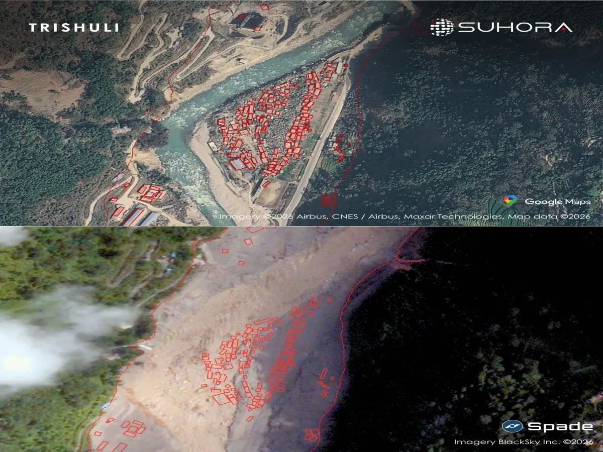
A huge flood rushed from the mountains through Nepal after ice, rocks and debris collapsed near the Nepal-Tibet border.
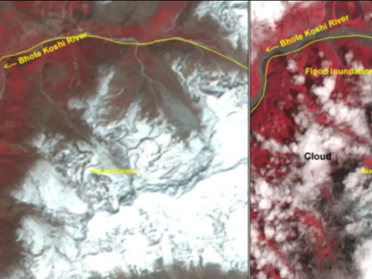
The water and debris travelled through the Bhote Koshi river system.
It buried parts of the towns of Trishuli and Betrawati and Tupche village.
Satellite pictures helped show the damage because many roads and bridges were destroyed.
Electricity equipment was also damaged, making communication harder.
Reports give different numbers for the people who died or are missing.
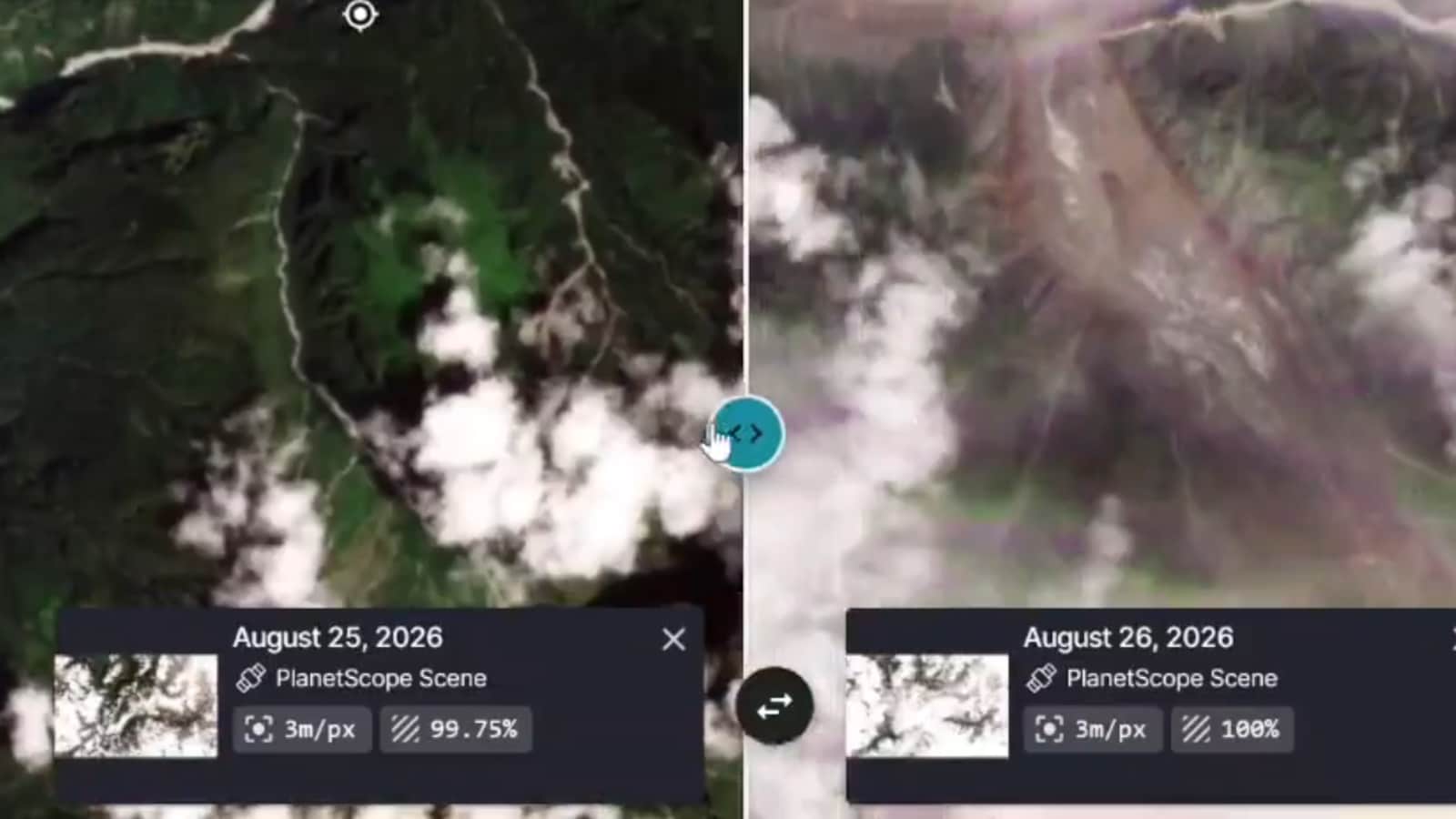
A new lake has formed near the place where the avalanche began.
Experts are watching it because the lake could overflow and cause another flood.

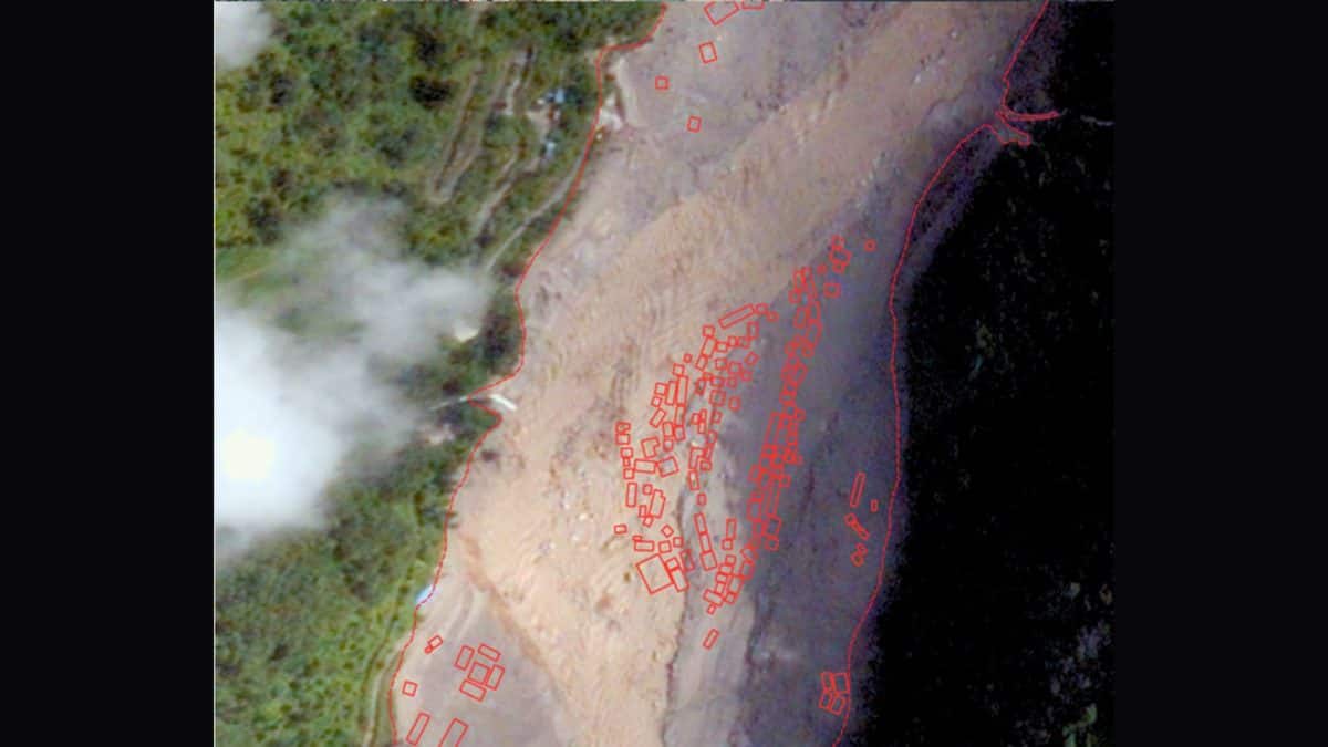
Satellite analysis shows Trishuli, Betrawati and Tupche buried under mud, silt, boulders and debris.
The Bhote Koshi flood damaged buildings, bridges, embankments, power lines and substations across central Nepal.
Officials said a 42-kilometre road between Betrawati and the Rasuwa border was completely destroyed.
Reported casualties vary between accounts, from 359 deaths and 826 missing to more than 570 deaths and 1,900 missing.
A newly formed 20.25-hectare lake near the avalanche source could create further downstream flooding if it breaches.
- Who
- Residents of Rasuwa and Nuwakot districts were affected; Suhora Technologies and government officials reported the damage.
- What
- A flash flood carrying ice, rocks, mud and debris buried riverside settlements and destroyed transport and power infrastructure.
- Where
- The disaster affected the Bhote Koshi-Trishuli-Narayani river system, including Trishuli, Betrawati, Tupche, Rasuwa and Nuwakot in Nepal.
- When
- The flood occurred on August 26, with satellite imagery of the newly formed lake captured on August 27, 2026.
- Why
- Articles attribute the flood to an ice-rock avalanche or glacial collapse near the Nepal-Tibet border, possibly involving a glacial lake outburst.
Key facts
- Affected settlements
- Satellite images showed major debris damage in Trishuli, Betrawati and Tupche.
- Road damage
- A 42-kilometre road from Betrawati to the Rasuwa border was reportedly destroyed.
- Infrastructure damage
- Buildings, bridges, embankments, power lines and substations were damaged or swept away.
- Casualty reports
- One account reported 359 deaths and 826 missing, including 517 foreign nationals; another reported more than 570 deaths and over 1,900 missing.
- Satellite assessment
- Suhora Technologies compared high-resolution images taken before and after the flood to identify visibly damaged structures.
- Newly formed lake
- Suhora said a lake of approximately 20.25 hectares had formed near the avalanche source in the Lhende Khola region.
- Further flood risk
- China's Ministry of Water Resources warned that an existing barrier lake was overflowing and could breach within three days.
Quotes
Suhora Technologies
India-based space-data analytics and intelligence firm that analyzed satellite imagery of the disaster area
“Bridges washed out, cutting off ground access to the area. Power lines and substations damaged, disrupting communications.”
 wionews.com
Sources
Related news

New Nepal Glacier Lake Raises Further Flooding Fears
Satellite Images Reveal Possible Cause of Devastating Nepal Floods

Nepal-Tibet Flash Floods Leave Hundreds Dead and Missing

Nepal Flood May Have Begun With Border Ice Avalanche
ISRO Links Nepal Floods to Massive Glacier Collapse

Bhote Koshi Flood Kills Eight, Nine Missing in Nepal
Nepal Plans New Landslide Warning System Along China Border

Nepal Thanks India as Glacial Disaster Rescue Efforts Continue
Nepal Warns of Heavy Rain After Deadly Floods
Nepal Flood Exposes Delayed Alerts and Cross-Border Warning Gaps

Bhotekoshi Flood Crisis: Nepal PM Shah Calls for Courage