2 days ago
Google DeepMind Builds India-First AI Models for Agriculture
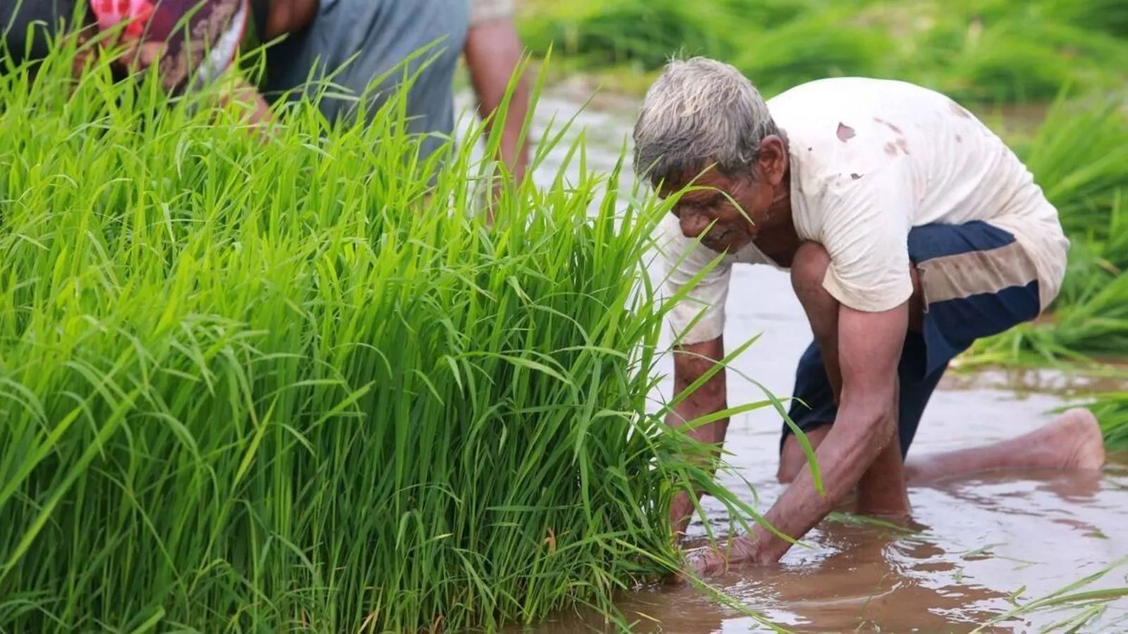
Google DeepMind is building computer tools to help farmers in India.
These tools study satellite pictures to understand where farms are and what crops are growing.
They can update information about crops during the growing season.
The tools may help people predict weather, detect crop problems, and use water and farm supplies more carefully.
Alok Talekar says the technology should give farmers better information, not replace them.
He also says it can work alongside useful traditional farming knowledge.
However, farmers and governments may need better technology skills and higher-quality data to use it well.
Several groups are already testing the tools for land records, loans, water planning, and environmental programs.

Google DeepMind’s AnthroKrishi team has developed AI models that map fields and monitor crops across India.
The models use satellite imagery to track field boundaries, crop types, sowing, and harvesting stages for 12 crops.
Alok Talekar said AI is intended to provide precise information while coexisting with traditional farming practices.
Potential uses include weather and disease prediction, input management, market intelligence, water management, and climate resilience.
Partnerships in Telangana, Karnataka, Andhra Pradesh, and elsewhere are applying the data to land records, credit, water management, and carbon credits.
- Who
- Google DeepMind’s AnthroKrishi team, led by Alok Talekar, along with government, private-sector, and nonprofit partners.
- What
- They developed satellite-based AI models to map agricultural land and monitor crops for farming-related services and decisions.
- Where
- The systems cover India and are being used or adapted through partnerships in Telangana, Karnataka, and Andhra Pradesh; the models also serve 11 countries in Asia Pacific and Africa.
- When
- The models use 15 years of imagery for field mapping, six years of data for crop monitoring, and crop data refreshed twice a month.
- Why
- The initiative aims to address information gaps, weather and climate risks, high input costs, limited resources, and unequal access to agricultural services.
AI-Assisted Agriculture
Traditional and Practical Farming
Role in farm decisions
AI-Assisted Agriculture
AI supporters say detailed, frequently updated data can make decisions more precise and help predict weather, diseases, input needs, and market conditions.
Traditional and Practical Farming
Traditional farming knowledge remains important, and farmers may continue using experience-based measures for weather, demand, prices, input quality, and pesticide decisions.
Environmental management
AI-Assisted Agriculture
AI can identify vulnerable fields, detect risks quickly, and support more efficient use of water and other inputs.
Traditional and Practical Farming
Some established practices can be harmful when relied on too heavily; Talekar specifically cited flooding rice fields as contributing to water overuse and environmental damage.
Scaling adoption
AI-Assisted Agriculture
Satellite-based models can treat small and large farms equally and help governments deliver services more fairly.
Traditional and Practical Farming
Challenges include data quality, limited technological awareness, and the need for tools that users can inspect and understand rather than relying only on technical APIs.
Key facts
- Lead researcher
- Alok Talekar leads agriculture and sustainability research at Google DeepMind and the AnthroKrishi team.
- Core models
- Agricultural Landscape Understanding (ALU) maps fields, trees, and water bodies; Agricultural Monitoring & Event Detection (AMED) monitors agricultural activity.
- Crop coverage
- The crop-monitoring system tracks crop types, sowing, and harvesting stages across 12 crops.
- Update frequency
- Crop-monitoring data is refreshed twice a month, while field-mapping data is refreshed every 6 to 12 months.
- Telangana application
- The Agriculture Data Exchange platform is using ALU and AMED to support innovations serving more than 5 million farmers.
- Karnataka application
- The state Water Resources Department is combining the models with weather and remote-sensing data across 2.6 million hectares of irrigated land.
- Data privacy
- Talekar said the satellite-based data contains no personal information such as names or phone numbers.
Quotes
Alok Talekar
Google DeepMind lead for agriculture and sustainability research and leader of the AnthroKrishi team
“I think what we are building is not opposed to traditional practices in any way. Our main role here is to provide information. We are not trying to influence actions one way or the other; we want to support effective decision-making.”
 indianexpress.com
“When you flood rice fields, that leads to the overexploitation of water resources. It can contribute to long-term desertification and also have a negative impact on the environment.”
indianexpress.com
Sources
Related news

India reaps AI gains from agriculture to healthcare: World Bank

Gates Foundation Sees India Leading AI Health, Agriculture Innovation
India's Space Sector Finds Biggest Impact Back on Earth
Drones and AI Help Monitor More Than a Million Trees

Krishi Darshan Started It; Bharat VISTAAR Can Complete It

Tea Board, ISRO and NIT Rourkela Launch AI Tea Monitoring

AI Reshapes Patient-Centric Healthcare and Life Sciences Progress
Google WeatherNext 3 Brings Hourly, Higher-Resolution Forecasts
G20 Agrees on Principles to Guide Emerging Technology
Google Cloud Expert Urges Contextual AI Defenses Against Cyberattacks