

Science & Tech · Space · 1 hr ago
Landsat 9 captures a mosaic of farms around Taiwan’s longest river
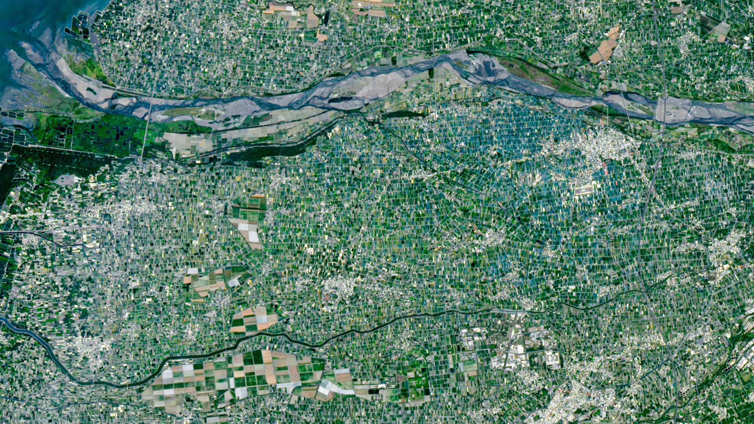
A Landsat 9 satellite captured a patchwork of small farms in western Taiwan.
The image shows tens of thousands of tightly packed farms in Yunlin County, on the Chianan Plain.
The farms surround the Zhuoshui River, Taiwan’s longest waterway.
The satellite took the image on April 24, 2026.
Its varied colors give the landscape a mosaic-like appearance from space.
The image provides a view of how farmland is arranged around the river in this part of Taiwan.

Landsat 9 captured an image of tightly packed farms around the Zhuoshui River in western Taiwan.
The river is Taiwan’s longest waterway.
The image shows tens of thousands of small farms forming a multicolored mosaic.
The photograph was taken on April 24, 2026.
The location is Yunlin County on the Chianan Plain.
- Who
- Landsat 9 captured the image.
- What
- The image shows a mosaic of tightly packed farms around the Zhuoshui River.
- When
- April 24, 2026.
- Where
- Yunlin County on the Chianan Plain in western Taiwan.
- Why
- Not stated.
This story does not have two clearly opposing sides.
This story does not have a timeline yet.
- Satellite
- Landsat 9
- Image date
- April 24, 2026
- Location
- Yunlin County, western Taiwan
- River
- Zhuoshui River, Taiwan’s longest waterway
- Farms
- Tens of thousands of small farms
Sources
Related news
Hubble data point to a possible second-generation planet around a white dwarf
NASA’s Perseverance rover sets record with 45.2km driven on Mars
New simulations suggest rare process forms Mars's giant Arsia Mons cloud
Aquarius is best seen on autumn evenings in the Northern Hemisphere
CHIME detects ancient hydrogen that could help probe dark energy

Hubble captures a galaxy cluster that looks like a cosmic smile

Scientists say some planets may be more habitable than Earth

French astronaut Sophie Adenot says space brought a full range of emotions
NASA releases nearly 800 GB of Artemis II lunar data
SpaceX set to send solar arrays and supplies to the space station
Webb finds an unusually dense galaxy cluster in the early universe