1 hr ago
Bay of Bengal System May Strengthen, Scientists Monitor Track
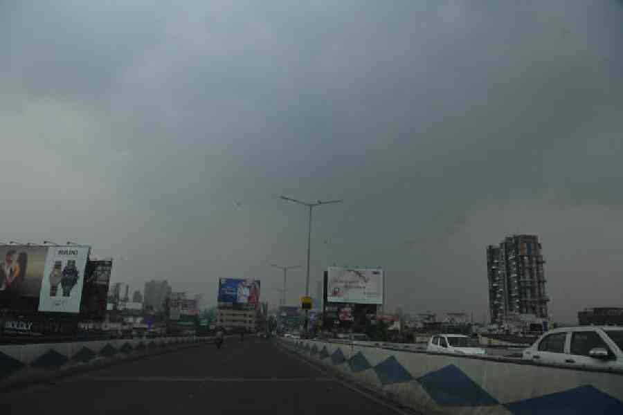
A weather system has formed over the sea near the Andaman Islands.
It is moving toward the Bay of Bengal.
Scientists think it may become stronger as it travels.
It could first become a depression and then a deep depression.
It might eventually become a cyclone, but that is not certain.
Warm seawater can give storms energy.
Strong winds high above the sea could weaken the system.
The official weather department has not issued a cyclone warning yet.
Parts of Bengal may get heavier rain and gusty winds from Tuesday.

A low-pressure area over the north Andaman Sea is moving west-northwestwards toward the Bay of Bengal.
The system could strengthen into a depression and then a deep depression near the west-central Bay.
It may approach the south Odisha-north Andhra Pradesh coast around Wednesday morning.
The India Meteorological Department has not issued a cyclone warning, though private agencies see greater intensification chances.
Bengal may receive heavier rain and gusty winds from Tuesday, especially in coastal areas.
- Who
- Weather scientists and the India Meteorological Department are monitoring the system; private weather agencies are also assessing it.
- What
- A low-pressure area may intensify into a depression, deep depression, or possibly a cyclone.
- Where
- It formed over the north Andaman Sea and may move toward the west-central Bay near the south Odisha-north Andhra Pradesh coast.
- When
- The system is expected to reach the west-central and adjoining northwest Bay around Wednesday morning; heavier rain in Bengal is forecast from Tuesday.
- Why
- Warm sea conditions may support intensification, although strong vertical wind shear could limit development.
Official Caution
Higher Intensification Concern
Likelihood of cyclone formation
Official Caution
The India Meteorological Department has not issued a cyclone warning, and officials said not every system reaches cyclone intensity.
Higher Intensification Concern
Private weather agencies and apps have indicated a higher likelihood of further intensification.
Factors affecting development
Official Caution
Strong vertical wind shear may hinder the system’s intensification, according to a meteorological official.
Higher Intensification Concern
Warm sea conditions during the October-to-December period could provide energy for the system to strengthen.
Key facts
- Current status
- A low-pressure area has formed over the north Andaman Sea and nearby regions.
- Movement
- The system is moving west-northwestwards.
- Potential development
- It may become a depression and then a deep depression, with cyclone development possible.
- Expected location
- The system may reach the west-central and adjoining northwest Bay near the south Odisha-north Andhra Pradesh coast.
- Official warning
- The India Meteorological Department has not issued a cyclone warning.
- Rain forecast
- Heavy rain is expected in coastal areas and some other parts of Bengal from Tuesday.
- Possible cyclone name
- If it becomes a cyclone, it would be named Arnab, a name provided by Bangladesh.
Quotes
Met official in Calcutta
A meteorological official in Calcutta describing the likely movement of the system’s remnants.
“But there are other factors. Strong vertical wind shear, for example, is detrimental to a cyclone’s intensification. We are in the late monsoon, but there is a strong possibility of vertical wind shear.”
 telegraphindia.com
“Monsoon has started retreating from the western parts of India. The remnant of the system is more likely to move towards Uttar Pradesh and Bihar, where the monsoon is still active.”
telegraphindia.com
Sources
Related news

Bay System Likely to Bring Heavy Rain Across Bengal
Depression Likely Over Bay as South Bengal Rain Continues
Low-Pressure System Brings Heavy Rain Across Bengal Through September

Odisha Alerts 20 Districts as Bay Low-Pressure System Develops

New Bay of Bengal Low Extends Tropical Disturbance Relay
Low-Pressure System May Bring Heavy Rain to Bengal

‘Cleared SIR, Voted’: Woman Challenges Husband’s Detention Before Court

India Face Bangladesh in Asian Games Cricket Semi-Final

India Faces Busy Asian Games Day With Medals In Sight

Bangladesh’s Possible Makkah Pact Signals a New Strategic Autonomy