

6 hrs ago
MMRDA Completes Land-Use Mapping Across 565 Villages
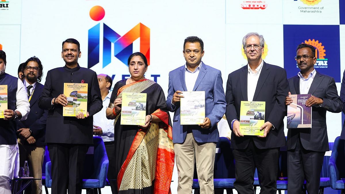
MMRDA has mapped how land is currently used across a large part of the Mumbai region.
The work covers 565 villages in areas of Raigad and Palghar.
It took two-and-a-half months to complete three reports.
The maps show things such as settlements, roads, natural features and existing land uses.
Planners want to use this information to decide where homes, workplaces and infrastructure could go.
They also plan to create computer models to test how different choices might affect transport, flooding and nature.
MMRDA says green areas, rivers, wetlands and other natural places will also need protection.
The reports are a starting point for future planning, not a final plan for every location.

MMRDA completed three Existing Land Use reports in two-and-a-half months, covering about 2,008 square kilometres and 565 villages.
The reports cover KSC New Town, Northern Extended Notified Area in Palghar, and Southern Extended Notified Area in Raigad, including Alibag.
Mapping used aerial LiDAR, high-resolution imagery, DGPS ground control, GIS mapping, cadastral records and field verification.
MMRDA plans to use the database for digital twins and scenario models to assess development effects on transport, services, flood risks and the environment.
The authority says about 45% of the combined study area is forest or green area, and planning will consider conservation alongside housing, jobs and infrastructure.
- Who
- The Mumbai Metropolitan Region Development Authority (MMRDA), whose Metropolitan Commissioner Dr Sanjay Mukherjee handed the reports to Chief Minister Devendra Fadnavis.
- What
- Completion of three Existing Land Use reports covering about 2,008 square kilometres and 565 villages.
- Where
- KSC New Town, Northern Extended Notified Area in Palghar, and Southern Extended Notified Area in Raigad, including Alibag.
- When
- Announced on October 3, 2026; the mapping exercise took two-and-a-half months.
- Why
- To provide a spatial basis for future metropolitan planning, including infrastructure, housing, employment and environmental management.
Key facts
- Total area
- About 2,008 sq km
- Villages covered
- 565
- Time to complete
- Two-and-a-half months
- KSC New Town
- About 324 sq km and 124 villages
- Northern ENA, Palghar
- About 1,007 sq km and 224 villages
- Southern ENA, Raigad
- About 677 sq km and 217 villages
- Green and forest areas
- About 45% of the combined study area
Quotes

Devendra Fadnavis
Chief Minister of Maharashtra
“We intend to turn this spatial database into a practical tool for shaping the region’s future. It will support digital twins, proposed land use and modelling of transport, infrastructure and development choices. Our goal is to create compact, connected centres where people can live closer to work, learning, healthcare and recreation, with greater access to open spaces and stronger climate resilience. This is the foundation for a more liveable MMR.”
 freepressjournal.in
“The completion of these ELU reports gives us a stronger foundation for planning Mumbai 3.0 and Mumbai 4.0. By bringing transport, employment, housing and environmental protection into one coordinated planning approach, we can spread opportunity across the metropolitan region. Our aim is to attract investment, create jobs and improve quality of life as MMR drives Maharashtra’s progress towards a USD 1 trillion economy.”
freepressjournal.in
Sources
Related news
Maharashtra Unveils Mumbai 3.0 Growth, Redevelopment and Technology Push
Maharashtra Road Agency Plans 6,000 Kilometres Of Expressways By 2047
Mumbai Suburban Rail Network Set for Major MUTP-IV Expansion
Fadnavis Sets Ten-Year Goal to Make Mumbai Slum-Free
MMRDA Showcases Mumbai Metro Projects To Belgian Prime Minister
Maharashtra Sanctions ₹426 Crore for Hinjawadi Roads, Connectivity

Rahul Gandhi Backs Maharashtra Students’ MPSC Satyagraha

Sapkal Says Youth Will Not Back Down Despite Cases

Leaders Celebrate Marathi Classical Language Pride Day

Maharashtra Signs Investment MoUs Worth Rs 8.57 Lakh Crore
