

2 hrs ago
Deep Depression Heads Toward Odisha-Andhra Coast, Heavy Rain Forecast

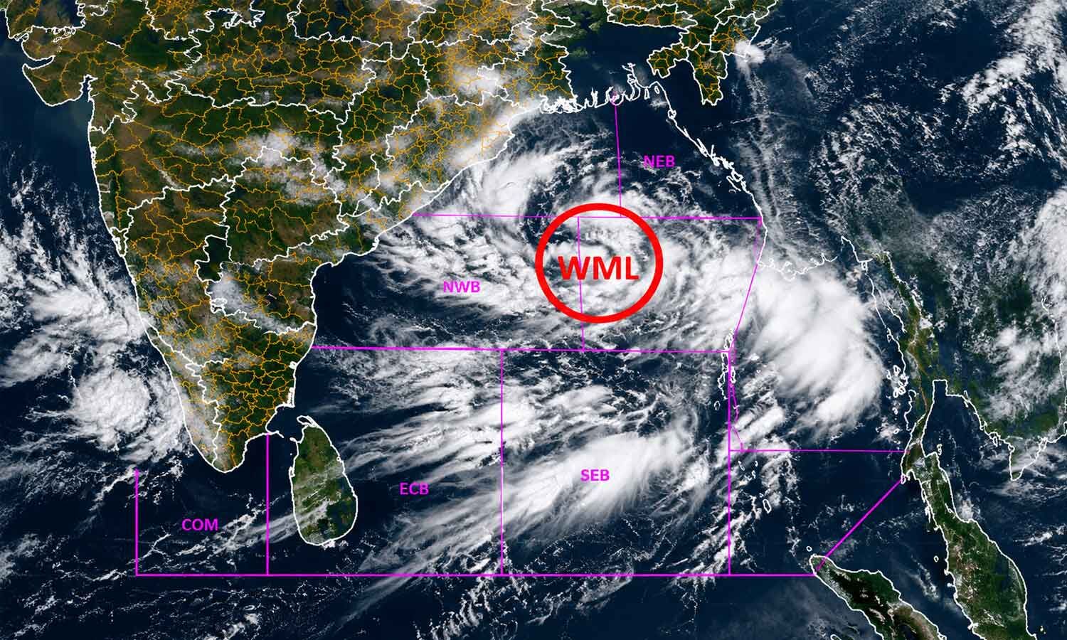
A strong weather system formed over the Bay of Bengal near Odisha and Andhra Pradesh.
It became a deep depression, which is stronger than an ordinary low-pressure area but weaker than a cyclone.
Weather officials expected it to reach land between Visakhapatnam and Gopalpur.
This was expected around the night of September 23 or early September 24.
Heavy and very heavy rain was expected in southern and coastal Odisha.
Some places could receive extremely heavy rain, causing floods, landslides and blocked roads.
The Odisha government prepared shelters and rescue teams in case people needed help.
Schools were closed in several districts, and some roads and ferry services were restricted.
Officials also warned fishermen to stay out of the sea because conditions could be dangerous.

The weather system intensified into a deep depression over the Bay of Bengal and was expected to cross between Visakhapatnam and Gopalpur.
The India Meteorological Department forecast heavy to extremely heavy rain across southern and coastal Odisha through September 24, with some rain possible afterward.
Red warnings were issued for several districts, including Koraput, Gajapati, Ganjam, Kalahandi, Nabarangpur and Malkangiri.
Odisha authorities prepared shelters, evacuation and rescue plans, cancelled employee leave, restricted travel and suspended some ferry services.
Schools and other educational institutions were closed in affected districts, while 33 ODRAF teams were deployed for emergency response.
- Who
- The India Meteorological Department and the Odisha government, district administrations and emergency teams.
- What
- A deep depression intensified and moved toward the north Andhra Pradesh-south Odisha coast, bringing forecasts of heavy to extremely heavy rain.
- Where
- The system was over the Bay of Bengal and was expected to cross between Visakhapatnam and Gopalpur, affecting southern and coastal Odisha.
- When
- The system was expected to cross the coast during the night of September 23 or early September 24; warnings covered September 23-25.
- Why
- The weather system threatened heavy rain, flooding, landslides, mudslides, strong squalls and rough seas.
Key facts
- Expected landfall
- Between Visakhapatnam and Gopalpur, around the night of September 23 or early September 24
- Rainfall threat
- Heavy to very heavy rain, with isolated extremely heavy rain in southern and coastal Odisha
- Red warnings
- Koraput, Gajapati and Ganjam for September 23-24; Kalahandi, Nabarangpur, Koraput and Malkangiri for September 24-25
- Wind threat
- Squalls with gusts of up to 75 kmph along and off the south Odisha-north Andhra Pradesh coasts
- Emergency response
- Thirty-three ODRAF teams were deployed, including 24 in vulnerable districts and nine in reserve
- Public restrictions
- Schools and educational institutions were closed in affected districts; some roads and Chilika ferry services were restricted
- Sea safety
- Fishermen were advised not to venture into the sea until September 24, and Puri banned sea bathing
Sources

Related news

Deep Depression Near Odisha Coast Likely to Bring Heavy Rain

Bay of Bengal Depression Heads Toward Andhra-Odisha Coast
Odisha Prepares for Heavy Rain as Deep Depression Nears Coast

IMD Warns Coastal Andhra Pradesh of Heavy Rain from Depression

Deep Depression Brings Heavy Rain, Flooding Across Andhra Pradesh
Fresh Bay Low-Pressure System Brings Heavy Rain To Odisha

Cyclone Arnab Strengthens, Three Indian States On Alert

Bay Depression To Intensify, Bringing Rain Across South Bengal

Ganjam Politics Shifts as Rivals Reconcile, Panda Faces Fresh Case
