13 hrs ago
Odisha Prepares for Heavy Rain as Deep Depression Nears Coast
Officials say Odisha is not facing a cyclone threat right now.
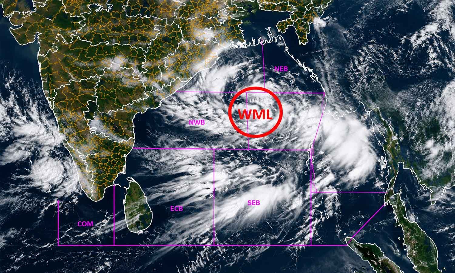
However, a strong weather system called a deep depression may form over the Bay of Bengal.
It could bring very heavy rain to parts of the state.
Rain is expected to increase from Tuesday.
The strongest effects may occur on September 23 and 24.
Government officials are preparing flood and relief centres.
Rescue teams will watch places that could flood or become cut off.
Hospitals are being asked to keep important medicines ready.
Fishermen have been told to return to shore and avoid the sea during the dangerous period.

Chief Secretary Anu Garg ruled out a cyclone threat to Odisha but warned of a possible deep depression.
The India Meteorological Department expects heavy to very heavy rain from Tuesday, intensifying over the following two days.
The system may move toward the north Andhra Pradesh-south Odisha coast and reach it around September 23.
Ganjam, Gajapati and Kandhamal districts face warnings for extremely heavy rainfall.
Collectors were told to prepare shelters, supplies, control rooms, medical resources and evacuation plans.
- Who
- Odisha Chief Secretary Anu Garg, the India Meteorological Department, district collectors and Odisha Disaster Rapid Action Force teams.
- What
- A possible deep depression is expected to bring heavy to very heavy rainfall, while officials prepare for flooding and related risks.
- Where
- Odisha and the north Andhra Pradesh-south Odisha coast, with several Odisha districts at risk.
- When
- Rain is expected to increase from Tuesday, with the system’s greatest impact forecast for September 23 and 24; fishermen were advised to return by the evening of September 21.
- Why
- The weather system over the Bay of Bengal may intensify and produce heavy rainfall, waterlogging and possible flooding.
Key facts
- Weather system
- A possible deep depression over the Bay of Bengal, not a cyclone.
- Rainfall timing
- Heavy to very heavy rain is forecast from Tuesday, with intensity increasing over the next two days.
- Expected landfall area
- Near the north Andhra Pradesh-south Odisha coast around the morning of September 23.
- Peak impact
- The system’s impact is expected to be highest on September 23 and 24.
- Most at-risk districts
- Ganjam, Gajapati and Kandhamal received warnings for extremely heavy rainfall.
- Preparedness actions
- Collectors were directed to ready flood and relief centres, essential supplies, control rooms and nodal officers.
- Marine advisory
- Fishermen were advised to return to the coast by the evening of September 21 and avoid the sea from September 22 to 24.
Quotes
Anu Garg
Odisha Chief Secretary who reviewed the State’s rainfall preparedness
“Today IMD has informed us that there is a likelihood of a deep depression forming, and not a cyclone, but a deep depression which would lead to heavy to very heavy rainfall”
 thehansindia.com
Sources
Related news

Deep Depression Near Odisha Coast Likely to Bring Heavy Rain

Fresh Bay Low-Pressure System Brings Heavy Rain To Odisha

Low-Pressure System Brings Heavy Rain to Odisha

Fresh Bay of Bengal System Brings Rain Threat to Odisha

Heavy Rain Batters Odisha as IMD Red-Warns Five Districts

Odisha Alerts 20 Districts as Bay Low-Pressure System Develops

IMD Issues Karnataka Rain Alerts as Heavy Showers Loom

Delhi-NCR Forecast Clear Skies as Temperatures Near 34°C

Bay of Bengal Depression Expected to Intensify Before Landfall
Heavy rain to continue across southern and eastern India