1 hr ago
History of Sunnam Cheruvu Reveals Hyderabad Lake Fight for Survival
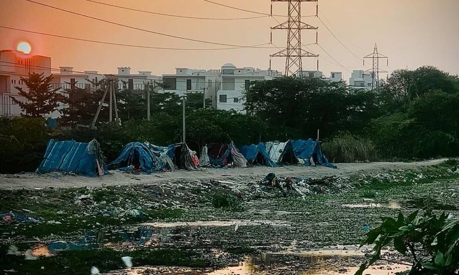
Sunnam Cheruvu is a lake in Hyderabad between Madhapur, Borabanda and Allapur.
It once covered about 24 to 32 acres and collected rainwater.
For many years, government departments helped supervise it.
As nearby cities and businesses grew, drains, buildings and sewage began putting pressure on the lake.
The lake’s protective earth wall, called a bund, also became weaker.
A local housing society was allowed to help repair the bund with its own money.
By 2013, the lake’s active water area had fallen to about 15 acres.
Government surveys and fencing were later used to protect the remaining lake area.

Sunnam Cheruvu was a 24-to-32-acre, rainwater-fed reservoir during the Nizam era and into the early 1990s.
The Panchayat Raj Department and district revenue authorities supervised the lake during the 1990s.
Rapid development around Madhapur, Borabanda and Allapur caused drainage problems, bund damage and encroachment pressures.
The Hari Co-operative Housing Society received permission to repair and secure the bund using private funds under technical supervision.
Uncontrolled sewage and land alterations reduced the active water surface to nearly 15 acres by 2013, after which boundary surveys and fencing supported conservation efforts.
- Who
- Sunnam Cheruvu, local residents and groups including the Hari Co-operative Housing Society, Panchayat Raj authorities, district revenue officials and municipal departments.
- What
- A historic lake has lost much of its water spread because of urban growth, sewage inflows and land changes, while authorities and local groups have worked to protect it.
- Where
- Between Madhapur’s IT corridor and the Borabanda–Allapur area of Hyderabad.
- When
- The lake was significant from the Nizam era into the early 1990s; pressures intensified in the 1990s and early 2000s, its water spread reached nearly 15 acres by 2013, and preservation efforts continued after 2014.
- Why
- Rapid real estate and infrastructure growth created drainage problems, damaged the bund and encouraged alterations around the lake’s Full Tank Level boundaries.
Key facts
- Original water spread
- Between 24 and 32 acres during the Nizam era and into the early 1990s.
- Water spread by 2013
- Nearly 15 acres.
- Lake type
- Rainwater-fed reservoir.
- Administrative supervision
- The Panchayat Raj Department and district revenue authorities supervised the lake during the 1990s.
- Bund restoration
- The Hari Co-operative Housing Society was authorised to repair the bund using private funds under technical guidance.
- Administrative transfer
- Control shifted from regional urban development bodies to unified municipal authorities during 2007–2008.
- Protection measures
- Municipal departments conducted boundary surveys and installed protective perimeter fencing.
Sources
Related news
Bihar Officers Praise HYDRAA’s Hyderabad Lake Restoration Efforts

Sunnam Cheruvu Restoration Nears Completion Ahead of Month-End Inauguration

How 2,000 Chitlapakkam Residents Revived a Sewage-Choked Lake

Residents Challenge HYDRAA Lake Restoration Near Sunnam Cheruvu
HYDRAA Restores Uppal Lake, Expands Public and Flood Protection
Officials Urge CSR Funds to Rejuvenate Hyderabad Lakes

BJP Stalls Telangana Assembly, Demands Inquiry Into Section 22A

Festive Sweet Prices Rise as Hyderabad Essentials Become Costlier

Visakhapatnam Launches Comprehensive Neuro Lab With Advanced Diagnostics

Hyderabad Businessman Dies by Suicide Inside Parked Car