

2 hrs ago
Heavy Rain Alert Issued as Low-Pressure System Advances Northwest

A weather system called a low-pressure area is moving across parts of India.
It may bring very heavy rain to some places in Andhra Pradesh.
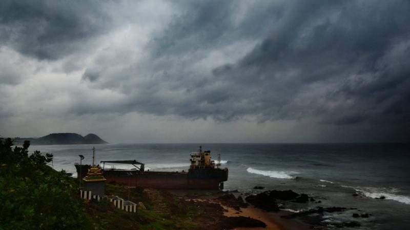
The north coastal districts of Andhra Pradesh are expected to be affected the most today and tomorrow.
The system is expected to move northwest toward the Vidarbha region within 24 hours.
Officials are watching low-lying areas because water could collect there or cause local flooding.
The weather department also expects rain and storms in states such as Telangana, Tamil Nadu and Kerala.
Some coastal areas could have strong, sudden winds.
People and local officials are being asked to stay alert while the system passes.

The Andhra Pradesh State Disaster Management Authority issued a heavy rainfall alert for isolated pockets over the next 48 hours.
North coastal Andhra Pradesh is expected to receive intense rainfall today and tomorrow as the system advances.
The low-pressure area spans southern Chhattisgarh, north coastal Andhra Pradesh and the south Odisha coast, and is forecast to move toward Vidarbha.
Authorities have told local administrations and disaster teams to monitor low-lying areas for waterlogging and localized flooding.
The India Meteorological Department forecast thunderstorms, lightning, gusty winds and isolated heavy or very heavy rain across several southern and central regions through September 18.
- Who
- The Andhra Pradesh State Disaster Management Authority, the India Meteorological Department, local administrations and disaster response teams.
- What
- A heavy rainfall alert has been issued because of an advancing low-pressure system, with possible flooding, thunderstorms and strong winds.
- Where
- North coastal Andhra Pradesh is expected to be most affected, with the system spanning southern Chhattisgarh, north coastal Andhra Pradesh and the south Odisha coast before moving toward Vidarbha.
- When
- The main alert covers the next 48 hours; the system is expected to move northwest over the next 24 hours, while wider forecasts extend through September 18.
- Why
- The low-pressure system is expected to produce heavy to very heavy rainfall, thunderstorms, lightning and gusty winds.
Key facts
- Alert period
- Heavy rainfall alert for the next 48 hours
- Most affected area
- North coastal districts of Andhra Pradesh
- System location
- Southern Chhattisgarh, north coastal Andhra Pradesh and the south Odisha coast
- Expected movement
- Northwestward toward the Vidarbha region over the next 24 hours
- Main risks
- Waterlogging, localized flooding, thunderstorms, lightning and gusty winds
- Peak wind forecast
- A thundersquall over Coastal Andhra Pradesh and Yanam could reach 50-60 kmph, with gusts up to 70 kmph
- Broader forecast
- Rainfall and storm activity are forecast across several southern states and territories through September 18
Quotes
Baswanth Reddy
Project Manager at the Andhra Pradesh State Disaster Management Authority
“Due to this low-pressure system, there will be heavy to very heavy rainfall today and tomorrow in isolated pockets of Andhra Pradesh...the north coastal districts will be mainly affected due to this low-pressure system as it moves toward Vidarbha over the next 24 hours,”
 deccanchronicle.com
Sources
Related news
Andhra Pradesh Issues Rain Alert Over Bay of Bengal System

Low Pressure System Brings Rain and Storms Across Andhra, Telangana

Low Pressure Brings Rain Forecasts for Andhra Pradesh and Telangana

Andhra Pradesh Issues Rain and Wind Alert for Northern Coast

Heavy Rain Forecast for Andhra Pradesh and Telangana Districts

Fresh Bay Low-Pressure System Brings Heavy Rain To Odisha

Man Sentenced to Death for Niece’s Rape and Murder

Satnami Leader Dhaldas Joins Congress, Challenging BJP in Chhattisgarh
One Student Dead, Two Missing in Hasdeo River

India Gives Over 80 Lakh HPV Vaccine Doses Nationwide
