3 hrs ago
DRDO HAPS Reaches 21 Kilometres in Stratospheric Flight Trial
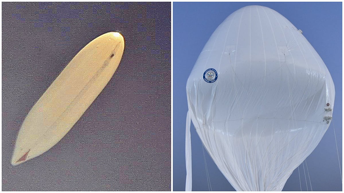
India’s defence research organisation tested a high-flying platform called HAPS.
It climbed to 21 kilometres above sea level.
It stayed around 20 kilometres high for more than 30 minutes.
While it was flying, it sent video and information about how it was working to people on the ground.
It was then brought down and recovered safely.
The information collected will help assess its performance.
The platform is being developed for long flights in the stratosphere.
The articles say systems like this could support surveillance, communication and monitoring.

DRDO said its indigenous High-Altitude Platform System reached 21 km above mean sea level during a flight trial.
The platform remained at about 20 km for more than 30 minutes before being commanded to descend.
It was recovered safely, and mission data was analysed to assess its performance.
The platform transmitted real-time video and vehicle performance data to a ground control station during the flight.
The trial was coordinated with the Indian Air Force and civil and aviation agencies; DRDO’s ADRDE is developing the system.
- Who
- The Defence Research and Development Organisation (DRDO), with the Indian Air Force and other agencies involved in the trial.
- What
- A successful flight trial of DRDO’s indigenous High-Altitude Platform System, which reached 21 km.
- Where
- The articles do not specify the trial location.
- When
- Tuesday, October 6, 2026, according to the ANI article.
- Why
- To test the platform’s stratospheric flight performance; it is being developed for long-endurance surveillance and monitoring applications.
Key facts
- Platform
- High-Altitude Platform System (HAPS)
- Peak altitude
- 21 km above mean sea level
- Time at altitude
- More than 30 minutes at around 20 km
- Flight data
- Real-time video and vehicle performance data were transmitted to the ground control station.
- Recovery
- The platform was recovered safely.
- Developer
- Aerial Delivery Research and Development Establishment (ADRDE), a DRDO laboratory in Agra
- Trial coordination
- The Indian Air Force, CEMILAC, DGCA, AAI and other civil authorities participated.
Quotes

Ministry of Defence
Indian government ministry reporting on the HAPS flight trial.
“The experimental flight attained an altitude of 21 km above mean mean level (AMSL) and remained at an altitude of 20 km AMSL for more than 30 minutes, before it was commanded to descend back to ground. The system was successfully recovered and flight performance data was analyzed”
 freepressjournal.in
 thehansindia.com
Sources

Related news

India’s Drone Revolution Moves From FPV Strikes to Long Missions

HAL Delivers Tejas, HTT-40 Trainers and Dhruv NG Helicopters

Bharat Forge, Pratt & Whitney Advance India’s HALE UAV

HAL Delivers Tejas Trainers, HTT-40s and Dhruv Helicopters

Harish Alladi Builds Indigenous Robotics and Anti-Drone Technologies

HAL to Hand Over Tejas, HTT-40s and Dhruv Helicopters
DRDO Opens Applications for One-Year Apprenticeship Training Programme

Hegseth’s Military Reforms Raise Questions for India
Report Details India’s Expanding Nuclear Delivery Capabilities

Scientist Bharathi Subramanian Blends Technology, Entrepreneurship and Spirituality