

World · East Asia & Pacific · 59 mins ago
Wildfire smoke blankets parts of Indonesia, reducing visibility
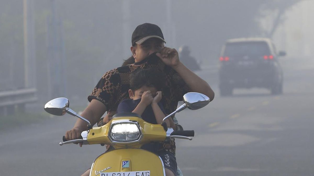
Smoke from forest and land fires has spread across parts of Indonesia, including Aceh and the Lake Toba area in North Sumatra.
Indonesia’s weather agency says smoke reaching Aceh came from fires in Kalimantan and central and southern Sumatra, while winds carried smoke from southern Sumatra toward Lake Toba.
The haze has obscured Lake Toba’s scenery, disappointing visitors who look forward to the views during ferry trips to Samosir Island.
In Aceh, visibility at several airports fell below normal, though measured air quality remained in the good-to-moderate range.
Some readings in Central Kalimantan reached hazardous levels, and the agency said haze also covered other parts of the country and crossed into Malaysia and Singapore.
The agency advised people not to burn land, to limit time outdoors and to wear a suitable mask when travelling.

Wildfire smoke has blanketed parts of Indonesia, including Aceh and areas around Lake Toba, reducing visibility.
BMKG said smoke reaching Aceh was carried from fires in Kalimantan and central and southern Sumatra.
At several Aceh airports, visibility ranged from 1,000 to 5,000 metres, below the usual level of more than 10 kilometres.
BMKG recorded 478 high-confidence hotspots across Indonesia on October 16, with 189 in South Sumatra.
Air quality in Aceh was rated good to moderate, while readings in two Central Kalimantan cities were in the hazardous category.
- Who
- Residents and travellers in affected parts of Indonesia, including Aceh and the Lake Toba area.
- What
- Wildfire smoke reduced visibility in several areas. BMKG said smoke was carried from fires elsewhere.
- When
- The reports were published on October 17 and 18, 2026; observations cited include October 14–17.
- Where
- Aceh, the Lake Toba area in North Sumatra, and other parts of Sumatra, Kalimantan, Sulawesi, Maluku and Papua.
- Why
- BMKG attributed the smoke in Aceh to fires in Kalimantan and central and southern Sumatra. Winds from the east to southeast carried smoke from southern Sumatra towards Lake Toba.
This story does not have two clearly opposing sides.
BMKG Silangit said winds from the east to southeast were carrying smoke from southern Sumatra towards the Lake Toba area.
BMKG reported 478 high-confidence hotspots nationwide, including 189 in South Sumatra.
BMKG’s Aceh station said smoke in the province was mainly carried from fires in Kalimantan and central and southern Sumatra.
PM2.5 readings in Pangkalan Bun and Palangka Raya were reported in the hazardous category.
- Aceh airport visibility
- 1,000–5,000 metres at five airports
- Normal airport visibility
- More than 10 kilometres, according to BMKG’s Aceh station chief
- High-confidence hotspots
- 478 recorded nationwide on October 16
- South Sumatra hotspots
- 189 on October 16
- Pangkalan Bun PM2.5
- 374.8 micrograms per cubic metre on October 17 at 11:00 WIB
- Palangka Raya PM2.5
- 342.8 micrograms per cubic metre on October 17 at 11:00 WIB
2 sources
What people are saying
Broadly speaking, this is transported smoke from forest and land fires
I’m disappointed, because usually the view during the crossing from Ajibata Port to Samosir is what I look forward to
The smoke in the Lake Toba area comes from hotspots in southern Sumatra