

World · East Asia & Pacific · 2 hrs ago
Gunung Lawu wildfire spreads toward hiking routes
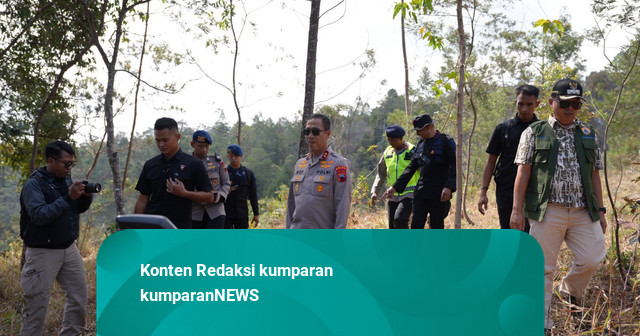
A wildfire on Mount Lawu in Central Java has continued to spread since it began on October 15.
By Monday, October 19, thermal drone monitoring had found 10 hotspots, up from nine earlier that morning.
The fire began near Gondosuli village in Karanganyar and has moved toward the Tambak hiking route and the Ngargoyoso area.
Difficult slopes, limited access to water and strong winds are making it hard for crews to control the flames.
Around 300 joint-response personnel have used firebreaks and hand tools, and helicopters have carried out water bombing.
All Mount Lawu hiking routes remain closed while the fire is being tackled.
Officials have been preparing an emergency disaster status, which could bring in national disaster agency coordination and other support.

A wildfire on the slopes of Mount Lawu in Central Java spread toward the Tambak hiking route and Ngargoyoso district by October 19.
A thermal drone detected 10 hotspots on the afternoon of October 19, up from nine that morning.
All Mount Lawu hiking routes remained temporarily closed while crews worked to contain the fire.
About 300 personnel were deployed on October 18, facing difficult terrain and limited access to water.
A report on October 17 estimated the burned area at about 100 hectares and said the Central Java police chief urged an emergency disaster status.
- Who
- Fire crews and joint response teams are tackling the wildfire. Central Java police chief Roy Hardi Siahaan urged an emergency disaster status.
- What
- A wildfire on Mount Lawu’s slopes spread toward hiking routes, with 10 hotspots detected on October 19.
- When
- The fire was reported to have started on October 15, 2026. It was still burning on October 19.
- Where
- Mount Lawu, Karanganyar district, Central Java, Indonesia, including the area near the Tambak hiking route.
- Why
- Strong winds were reported to affect the fire’s movement. The cause of the fire was not stated.
This story does not have two clearly opposing sides.
The fire was reported to have started on the slopes of Mount Lawu.
A report estimated the burned area at about 100 hectares, and the Central Java police chief urged authorities to establish an emergency disaster status.
The fire remained unextinguished, all hiking routes were still closed, and about 300 personnel were deployed.
Responders reported nine hotspots.
A water-bombing operation was carried out after an earlier delay due to poor weather.
A thermal drone detected 10 hotspots, and the fire was reported to be approaching the Tambak route and Ngargoyoso.
- Location
- Mount Lawu, Karanganyar district, Central Java
- Start date
- October 15, 2026
- Hotspots
- 10 detected at 16:00 local time on October 19
- Burned area estimate
- About 100 hectares, reported October 17
- Personnel
- About 300 deployed on October 18
- Hiking routes
- All routes remained temporarily closed
3 sources
What people are saying
The location is on the slopes. Reaching it requires caution. We prioritize safety because water cannot be brought up.
We are worried this could happen like in 2023, when we could not predict the wind; it could spread as far as East Java.
The colleagues have worked hard since morning to make manual firebreaks by clearing undergrowth so the fire does not grow. But if the mountain wind keeps blowing, it carries the fire.