

Archive · 27 Aug 2026
How Glacier Loss Is Intensifying Nepal’s Mountain Disasters
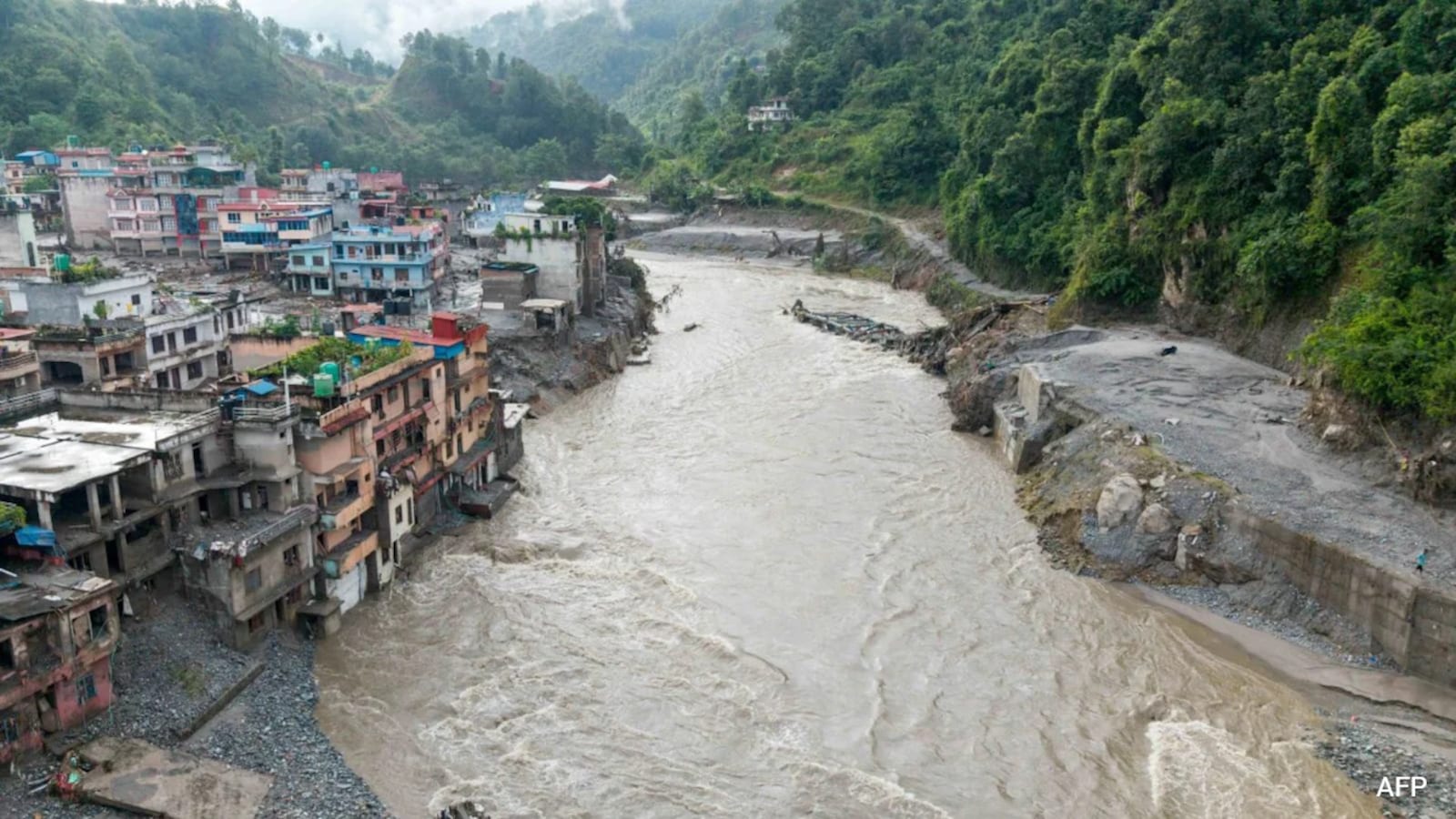
Nepal’s high mountains are warming, and this is changing the ice and snow there.
Glaciers are shrinking and leaving loose rocks and dirt behind.
Rain is also falling at higher elevations where snow used to accumulate.
Water can collect behind these loose materials, forming lakes near glaciers.
If a natural dam breaks, a huge flood can rush down the valleys.
On August 26, 2026, an ice-and-rock avalanche in the border region caused such a dangerous chain of events.
The flood affected rivers, settlements, people, and hydropower facilities.
Scientists say mountain communities need warning systems that work across national borders.
Areas above 2,800 metres are considered especially exposed.

A high-altitude glacial collapse near Nepal’s Tibet border produced a seismic signal equivalent to magnitude 5.2.
An ice-rock avalanche from nearly 5,200 metres temporarily dammed the Lhende Khola before the barrier breached.
The resulting surge struck the Bhote Koshi and Trishuli river systems, destroying settlements and damaging hydropower infrastructure.
Scientists link the growing risk to warming, rising rainlines, glacier retreat, and unstable moraine deposits.
Experts say areas above 2,800 metres are especially vulnerable to glacial lake outburst floods and debris flows.
- Who
- Residents and communities in Nepal’s Rasuwa district and nearby mountain valleys were affected; the event was analyzed by the United States Geological Survey, the International Centre for Integrated Mountain Development, and Kathmandu University.
- What
- A high-altitude ice-rock avalanche and subsequent river surge caused widespread destruction, deaths, missing people, and infrastructure damage.
- When
- August 26, 2026; the seismic signal was recorded at 8:37 a.m. local time.
- Where
- Nepal’s Rasuwa district and Tibet border region, including the Lhende Khola catchment and the Bhote Koshi and Trishuli river systems.
- Why
- Glacier retreat, atmospheric warming, shifting precipitation, unstable moraine, and the breaching of a temporary natural river dam contributed to the disaster.
- Date
- August 26, 2026
- Seismic signal
- Equivalent to a magnitude-5.2 event, according to the United States Geological Survey
- Avalanche elevation
- Nearly 5,200 metres
- Affected catchment
- Lhende Khola
- Affected river systems
- Bhote Koshi and Trishuli
- Highest-risk elevation
- Areas above 2,800 metres
- Damaged infrastructure
- Downstream hydropower facilities