Archive · 24 Sep 2026
Deep Depression Crosses Kalingapatnam Coast as Heavy Rain Continues
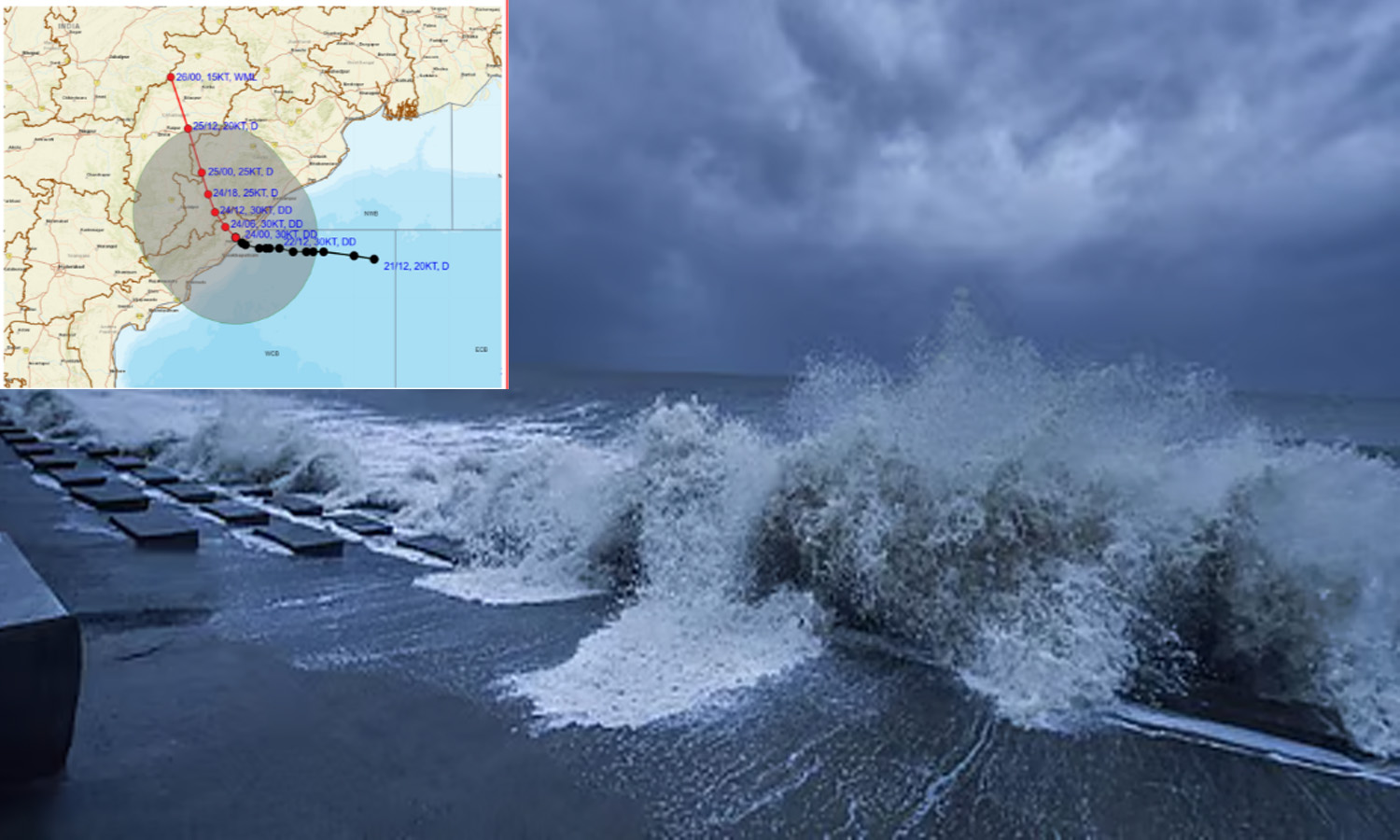
A strong weather system called a deep depression crossed the coast near Kalingapatnam.
It brought heavy rain to parts of Andhra Pradesh and nearby areas.
The system was moving slowly at about 3 kmph.
Its strongest winds reached about 75 kmph.
Forecasters expect it to remain a deep depression for about 12 more hours.
After that, it should gradually become weaker over the next day.
Some cities and low-lying areas have already experienced flooding.
People have been asked to stay careful because more rain could cause flash floods.

The deep depression crossed the coast near southwest Kalingapatnam between 11 p.m. Wednesday and 1 a.m. Thursday.
The system moved west-northwestward at about 3 kmph, with maximum sustained winds reaching 75 kmph.
It was centered about 50 km west of Kalingapatnam at 5:30 a.m. and is expected to maintain deep-depression strength for 12 more hours.
The system is forecast to move north-northwestward and weaken gradually during the following 24 hours.
Heavy rain has inundated low-lying areas, while more than 100 mm was recorded at 80 locations and flash-flood risks remain.
- Who
- The India Meteorological Department and Andhra Pradesh State Disaster Management Authority reported the system; residents in affected districts face heavy rain and flooding risks.
- What
- A deep depression crossed the coast near Kalingapatnam and continues to produce heavy rainfall.
- When
- The system crossed between 11 p.m. Wednesday and 1 a.m. Thursday; it was expected to remain a deep depression for 12 hours and weaken over the next 24 hours.
- Where
- Near southwest Kalingapatnam in Srikakulam district, with impacts across parts of Andhra Pradesh and Telangana.
- Why
- The weather system is generating widespread heavy rain, inundating low-lying areas and creating a risk of flash floods.
- Landfall area
- Near southwest Kalingapatnam, Srikakulam district
- Landfall period
- Between 11 p.m. Wednesday and 1 a.m. Thursday
- Recent movement
- West-northwestward at about 3 kmph
- Maximum winds
- Up to 75 kmph
- Expected intensity
- Likely to remain a deep depression for 12 more hours
- Rainfall recorded
- More than 100 mm at 80 locations during the previous 24 hours
- Safety concern
- Flash floods in low-lying areas; caution advised for 48 hours after landfall