

Archive · 31 Jul 2026
Depression over Bay of Bengal Revives Telangana Monsoon
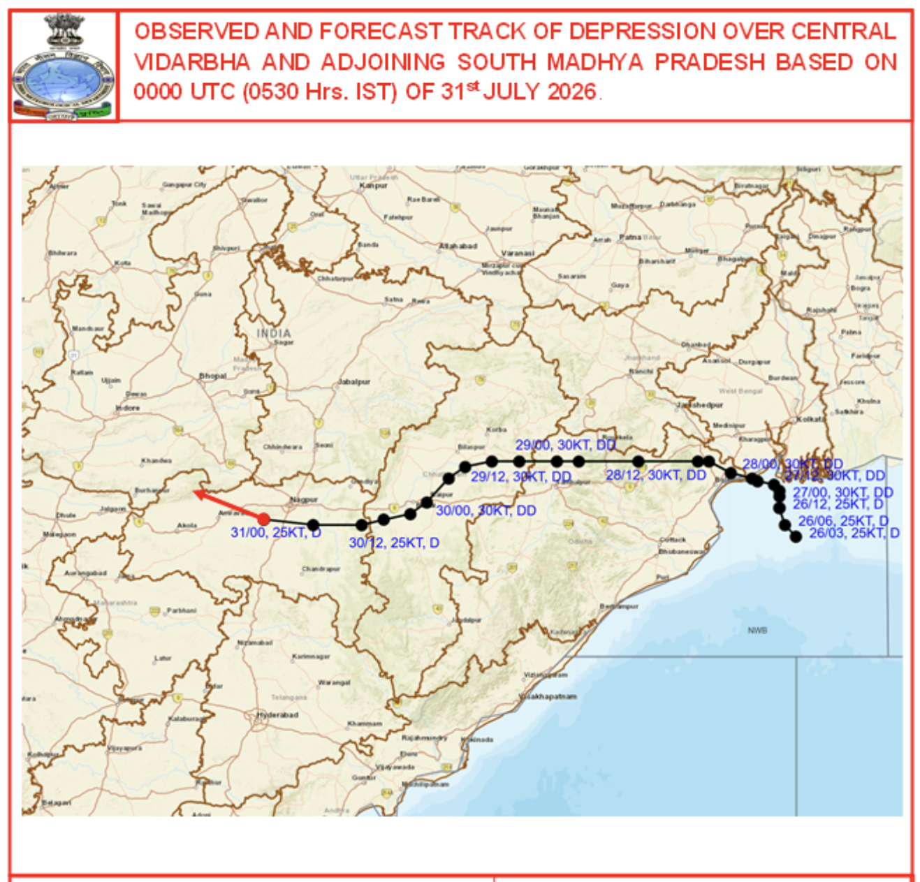
A big rainstorm called a depression formed over the Bay of Bengal.
It pulled wet air from the sea and brought it to Telangana, a state in India.
Telangana had been very dry for three weeks, but the depression made it rain in just a few days.
This helped the state’s water levels get better.
Scientists say the depression is smaller than a cyclone and is a normal part of the monsoon season.

Telangana’s rainfall deficit fell from 33% to –5% after a deep depression formed over the Bay of Bengal.
The depression drew moisture from both the Bay of Bengal and the Arabian Sea, delivering rain to Telangana, Madhya Pradesh, Chhattisgarh, Maharashtra, and Karnataka.
Meteorologist Dr G.N.R.S. Srinivas explained that depressions are smaller than cyclones, with vertical heights of 5–8 km versus 15–18 km.
The monsoon had stalled for three weeks, but the depression brought rain in 2–3 days, dramatically reducing the deficit.
The Indian Ocean Dipole and El Niño were not cited as primary factors; the depression was deemed the main cause.
- Who
- Dr G.N.R.S. Srinivas, senior meteorologist from the India Meteorological Department
- What
- A deep depression over the Bay of Bengal brought rain to Telangana, reducing its rainfall deficit
- When
- Late July 2025
- Where
- Telangana and surrounding Indian states
- Why
- The depression drew moisture from the Bay of Bengal and Arabian Sea, countering a previous monsoon lull
- Initial rainfall deficit
- 33% (negative) before depression
- Current rainfall deficit
- -5% after depression
- Cause of rainfall
- Deep depression over Bay of Bengal
- Affected states
- Telangana, Madhya Pradesh, Chhattisgarh, Maharashtra, Karnataka
- Meteorologist
- Dr G.N.R.S. Srinivas, IMD