

Archive · 16 Jan 2026
Detailed Map Reveals Antarctica's Hidden Terrain
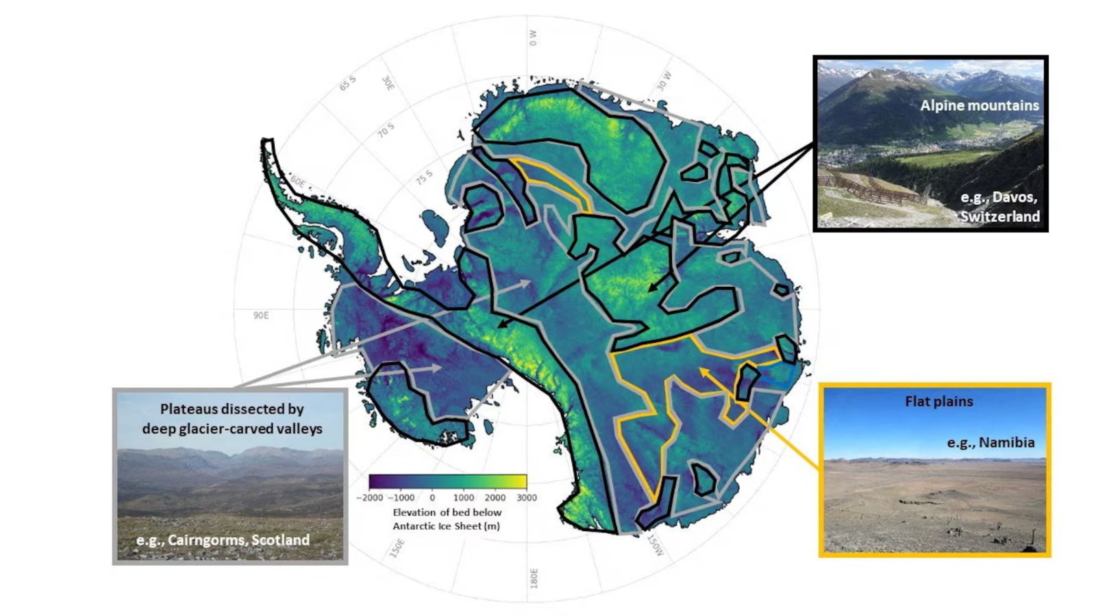
Scientists have made a very detailed map of the land hidden under Antarctica's ice.
They found lots of mountains, valleys, and hills that were not known before.
This map is important because it helps scientists understand how the ice will melt and affect the sea level.
The ice in Antarctica is very thick, and the land under it has different shapes and sizes, just like other continents.
The scientists used special methods and satellites to make this map, which is more complete than any other map before.
They hope this will help make better predictions about climate change and sea-level rise.

Scientists created the most detailed map of Antarctica's subglacial terrain, revealing mountains, canyons, valleys, and plains.
The map identified over 30,000 previously uncharted hills and other smaller features.
The researchers used ice-flow perturbation analysis and high-resolution satellite observations to map the entire continent.
The map is crucial for improving forecasts about the climate-related retreat of Antarctica’s ice sheet and its impact on global sea-level rise.
Antarctica's subglacial features were initially sculpted before the continent was covered in ice over 34 million years ago.
- Who
- Researchers led by glaciologist Robert Bingham of the University of Edinburgh and Helen Ockenden of the Institut des Geosciences de l’Environnement in France
- What
- Created the most detailed map of the subglacial terrain of Antarctica, revealing mountains, canyons, valleys, and plains
- When
- The study was published this week in the journal Science
- Where
- Antarctica
- Why
- To improve forecasts concerning the climate-related retreat of Antarctica’s ice sheet and to better understand the subglacial bedrock landscape
- Size of Antarctica
- 40% larger than Europe, 50% larger than the United States, and roughly half the area of Africa
- Ice Sheet Thickness
- Average of 1.3 miles (2.1 km), with a maximum of 3 miles (4.8 km)
- Freshwater Content
- 70% of the planet's freshwater
- Mapping Method
- Ice-flow perturbation analysis and high-resolution satellite observations
- Newly Identified Features
- More than 30,000 previously uncharted hills
- Study Publication
- Journal Science
- Lead Researchers
- Robert Bingham (University of Edinburgh) and Helen Ockenden (Institut des Geosciences de l’Environnement)