

Archive · 30 Oct 2025
Hyderabad Numaish to Feature Drone-Mapped Digital Layout
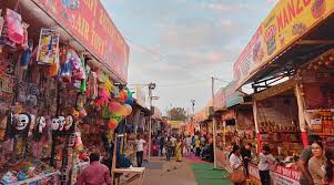
Imagine going to a big fair called Numaish.
It's so big that it can be hard to find where you want to go!
To help everyone, they are using a special camera on a drone to take pictures of the whole fair.
This will create a digital map, like on Google Maps, so you can see exactly where each stall is.
It will also show you what things cost and help emergency vehicles find you quickly if there's a problem.
Printed maps will also be put up at the fair entrance to make it even easier to find your way around.

Hyderabad's Numaish exhibition will feature a new drone-based mapping project.
The project aims to create a digital pathway map of all 22 acres of the fairgrounds.
The digital map will be accessible via Google Maps, allowing visitors to locate specific stalls.
Geographical Information System (GIS) data will be used to display stall locations and cost details.
The digital map is expected to enhance safety by assisting emergency services in locating incidents.
- Who
- Numaish organising committee and Economic Committee
- What
- A drone-based mapping project to create a digital pathway map of all stalls
- When
- Upcoming Numaish exhibition
- Where
- Hyderabad
- Why
- To improve accessibility, safety, transparency, and convenience for exhibitors and visitors, and to aid in emergency situations.
- Exhibition Area
- 22 acres
- Mapping Technology
- Drone survey and GIS data
- Data Submission Deadline
- November 1
- Altitude of Drone Survey
- 50 meters
- Image Resolution
- 1.4 centimeters per image