

Archive · 7 Sep 2026
India insists UN maps accurately depict J&K, Ladakh
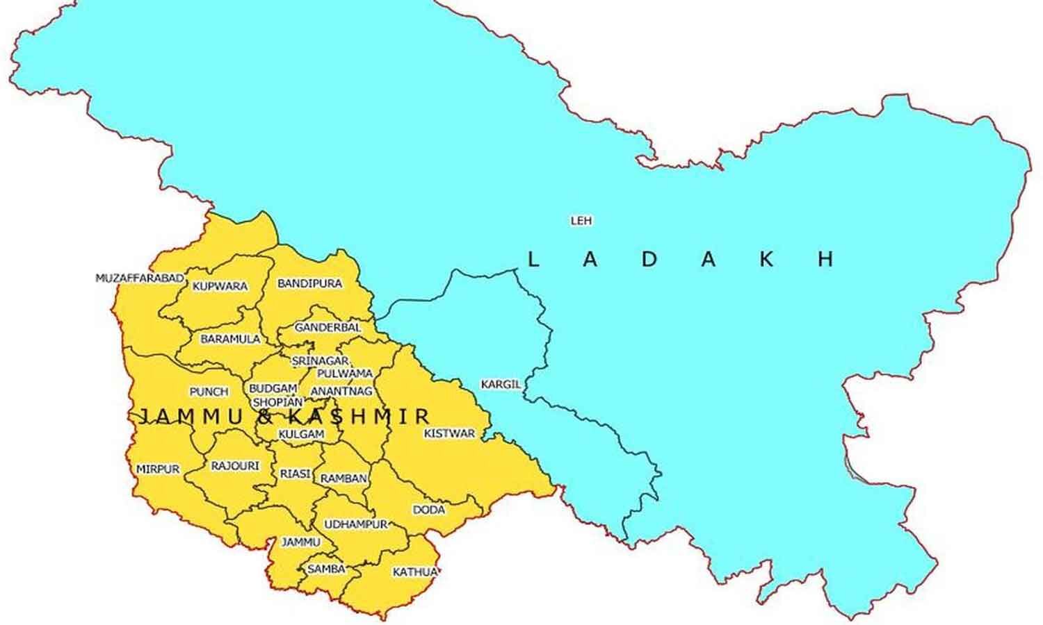
India wants maps made by the United Nations to show Jammu and Kashmir and Ladakh according to India’s official map.
The government said incorrect or misleading depictions would not be acceptable.
India had voted for a UN resolution about making world maps show continent sizes more fairly.
The resolution was adopted on September 4.
India explained that supporting the resolution did not mean approving any particular map.
The resolution focuses on map projections, not political borders or disputed territories.
The vote received 164 votes in favour.
The United States was the only country to vote against it, while six countries abstained.

India said Jammu and Kashmir and Ladakh must appear according to its official map.
The statement followed India’s support for a UN resolution promoting more accurate world maps.
India said the resolution does not endorse any specific map, projection or national boundary depiction.
The resolution encourages equal-area projections that preserve the relative sizes of continents.
The resolution passed with 164 votes in favour, six abstentions and one vote against.
- Who
- The Government of India, represented by External Affairs Ministry spokesperson Randhir Jaiswal.
- What
- India demanded that Jammu and Kashmir and Ladakh be depicted according to its official map while clarifying its support for a UN map-related resolution.
- When
- India made the statement on Sunday, two days after voting for the resolution adopted on September 4.
- Where
- New Delhi and the United Nations General Assembly.
- Why
- India said its sovereign territory must be represented accurately and that misleading depictions are unacceptable.
- Resolution title
- “Correct the Map: Rebalancing Global Cartographic Representation and Promoting Equitable Representation of the World’s Regions, Particularly Africa”
- Adoption date
- September 4
- Indian position
- Jammu and Kashmir and Ladakh must be shown according to India’s official map.
- Resolution purpose
- To encourage equal-area map projections that preserve the relative sizes of continental landmasses.
- Votes in favour
- 164
- Abstentions
- Estonia, Georgia, Lithuania, Moldova, Serbia and Ukraine abstained.
- Vote against
- The United States cast the lone vote against.