

Archive · 22 Jul 2026
Heavy Rain Triggers Landslides in North Bengal and Sikkim
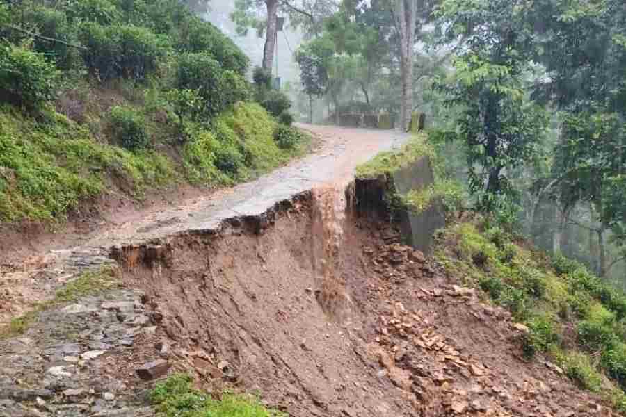
Heavy rain in North Bengal and Sikkim caused landslides that blocked roads and made rivers rise close to dangerous levels.
The main highway connecting Sikkim and Kalimpong was briefly closed, but workers quickly cleared the debris.
In Sikkim, a bridge collapsed, cutting off access to four areas.
The weather experts say more rain is expected, so people should be careful.

Heavy rainfall triggered multiple landslides in North Bengal and Sikkim, disrupting traffic on NH10 and NH110.
Water levels of the Teesta and Mahananda rivers rose close to their danger marks but receded in the afternoon.
Landslides damaged rural roads in Darjeeling, including a GTA link road and a PMGSY road.
In Sikkim, NH10 remained blocked at 20th Mile due to continuous rain, with an alternative route open for traffic.
A bridge collapsed in Pakyong district, disrupting access to four wards, including a senior secondary school.
- Who
- Residents, travelers, local authorities, and meteorological experts
- What
- Heavy rainfall triggered landslides and disrupted traffic and infrastructure
- When
- Over the past 24 hours, beginning late Monday evening and continuing through Tuesday morning
- Where
- North Bengal and neighboring Sikkim, including Darjeeling, Kalimpong, Siliguri, and East Sikkim
- Why
- Incessant monsoonal rainfall led to landslides and infrastructure damage
Local Authorities
Residents and Travelers
Response to Landslides
Local Authorities
Local authorities and NHIDCL quickly cleared debris and restored traffic on NH10 and NH110.
Residents and Travelers
Residents and travelers faced disruptions in traffic and access to essential services due to landslides and blocked roads.
- Rainfall in Darjeeling
- 133mm
- Rainfall in Kalimpong
- 120mm
- Mahananda River Level
- 113 metres (danger mark: 115 metres)
- Teesta River Level
- 146 metres (danger mark: 150 metres)
- Forecasted Rainfall
- 110mm in Kalimpong, Jalpaiguri, and Alipurduar districts