

Archive · 1 Jul 2025
FireSat Satellite Detects Wildfires from Space
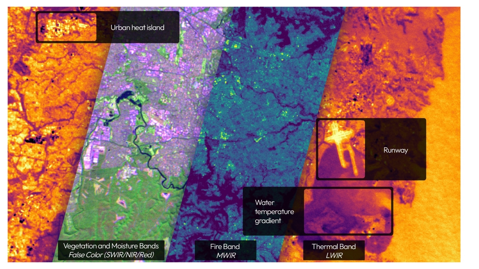
Imagine a special satellite that can see where wildfires are happening, even from space.
This satellite, called FireSat, uses special cameras to spot heat, like the heat from a fire.
It's like a super-powered eye that can see through smoke.
The satellite is able to quickly scan the entire Earth for wildfires.
This helps firefighters and people in charge know where fires are and how big they are.
The goal is to launch many more of these satellites to watch the whole planet and help protect us from wildfires.

Muon Space launched the FireSat Protoflight satellite in March.
The satellite uses multi-band infrared instruments to detect wildfires.
It can scan areas over 1,500 kilometers and identify fires as small as five-by-five meters.
The satellite can differentiate between false positives and actual wildfire threats.
Muon plans to launch a constellation of 50 satellites, with full operation by 2030.
- Who
- Developed by Muon Space in collaboration with Earth Fire Alliance.
- What
- FireSat Protoflight satellite detects wildfires using infrared sensors.
- When
- Launched in March, with full operation of the constellation planned by 2030.
- Where
- Scanning Earth from space; first images from low-Earth orbit.
- Why
- To provide real-time data to first responders, policymakers, and communities facing wildfire threats.
- Satellite Name
- FireSat Protoflight
- Launch Date
- March
- Technology
- Multi-band infrared (IR) instrument
- Scanning Capability
- 1,500+ kilometers at a time
- Fire Detection Size
- 5x5 meters
- Scanning Frequency
- Every twenty minutes (global coverage)
- Planned Satellites
- 50
- Full Operational Goal
- 2030