

12 hrs ago
Bhopal Bhoj Wetland Demarcation: Drone Survey Faces 15-Day Deadline
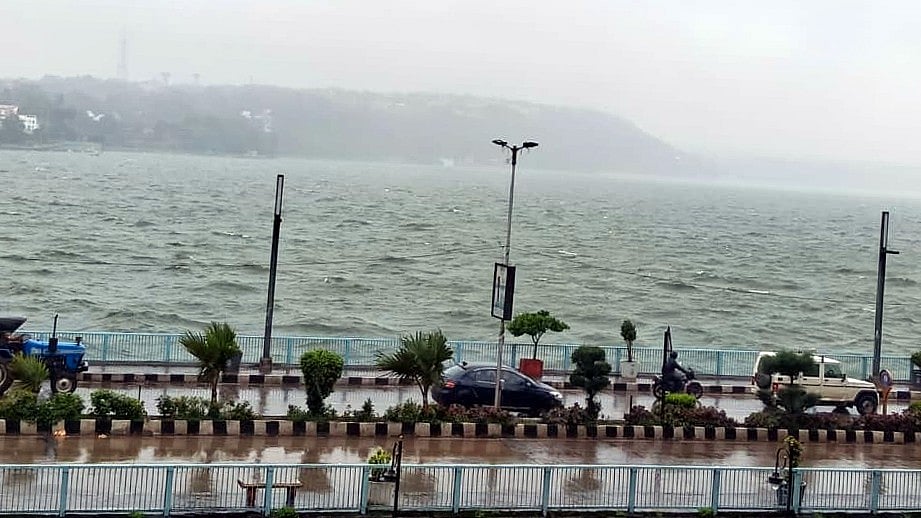
Officials are preparing to redraw the boundaries of important wetlands and water bodies in Bhopal.
The work follows instructions from the National Green Tribunal.
A drone survey may start on Saturday if the weather and water levels are suitable.
The survey team will meet at Bhadbhada at 9 a.m.
The water level needs to reach and settle at a set height called the Full Tank Level.
Experts and government engineers will inspect the area and compare maps with boundary markers.
The work will also use satellite pictures and other mapping tools.
The committee has 15 days to finish the new boundary survey.

A drone survey of the Bhoj Wetland, Kerwa and Kaliasot water bodies may begin Saturday, weather and water levels permitting.
The Madhya Pradesh Pollution Control Board is coordinating the exercise under National Green Tribunal directions.
The survey must be conducted when water reaches and stabilizes at the prescribed Full Tank Level, according to officials.
A seven-member committee, including a four-member expert panel, has been formed to complete the demarcation.
The 15-day exercise will use drone mapping, geo-tagging, ground-truthing, remote sensing, satellite imagery and marker verification.
- Who
- The Madhya Pradesh Pollution Control Board, a seven-member committee, Bhopal officials and environmental and technical experts.
- What
- A fresh demarcation of the Bhoj Wetland, Kerwa and Kaliasot water bodies using drone and other mapping methods.
- Where
- Bhadbhada and the Bhoj Wetland, Kerwa and Kaliasot water bodies in Bhopal, Madhya Pradesh.
- When
- The drone survey may begin Saturday; the committee has 15 days to complete the demarcation.
- Why
- To comply with directions from the National Green Tribunal and establish the wetlands’ boundaries at the prescribed Full Tank Level.
No gate release at Full Tank Level
Gate release if level exceeds Full Tank Level
How water levels should be managed
No gate release at Full Tank Level
The National Green Tribunal direction was reported as requiring wetland gates to remain closed once the water reaches the Full Tank Level, so boundaries can be determined without gate release.
Gate release if level exceeds Full Tank Level
Bhopal Municipal Corporation officials said the Tribunal also permitted opening a gate if the water level crosses the Full Tank Level, followed by closure once the level stabilizes.
Key facts
- Nodal agency
- Madhya Pradesh Pollution Control Board
- Deadline
- 15 days
- Committee
- Seven members, including a four-member expert panel
- Survey methods
- Drone mapping, geo-tagging, ground-truthing, remote sensing and satellite imagery
- Starting point
- Bhadbhada, where the team is scheduled to meet at 9 a.m.
- Drone permission
- The Centre has permitted drone operations within the wetland’s no-fly zone
- Conditions
- Visibility, rainfall and water level will determine when the drone flight begins
Sources
Related news
Bhopal’s Bhoj Wetland Set for Seventh Boundary Demarcation
NGT Orders Bhopal Lake Sewage Mapping, Zero Untreated Discharge Plan
Bhadbhada Dam Opens Gates as Heavy Rain Fills Bhopal Lake
NGT Orders Encroachment Removal Measures Around Shahpura Lake

NGT Reviews Petrol Pump Construction Over Bhopal Drain
Chennai Begins Drone Survey of 44 Canals Ahead of Monsoon
