Archive · 4 Sep 2026
Supersized El Niño Could Become Strongest Ever, UN Warns
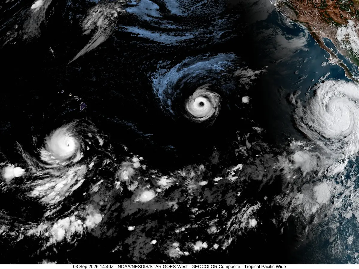
El Niño is a natural event that makes parts of the Pacific Ocean unusually warm.
It happens when trade winds weaken.
The extra warmth can change rain, wind and temperatures across many parts of the world.
Scientists say this El Niño is growing stronger and could become the strongest ever recorded by modern monitoring.
It is expected to reach its highest strength near the end of 2026.
Forecasts say it will probably continue through February 2027.
It could bring more floods, droughts and very hot weather.
These changes may harm farms, water supplies, energy systems and health services.
Officials are preparing early warnings and other plans to help communities respond.

The World Meteorological Organization says El Niño may intensify to the strongest level recorded since modern monitoring began.
Forecasts indicate a nearly 100% likelihood that El Niño will continue through February 2027.
Central-eastern Pacific waters are more than 2°C above average, with weekly readings reaching about 2.6°C above normal.
The event is expected to peak toward the end of 2026 and could help make 2027 the warmest year on record.
The WMO warns of increased risks of floods, droughts, extreme heat and disruption to food, water, energy and health systems.
- Who
- The World Meteorological Organization, WMO Secretary-General Celeste Saulo and United Nations Secretary-General Antonio Guterres.
- What
- A powerful El Niño is intensifying and could become the strongest recorded, increasing the risk of extreme weather and record global heat.
- When
- The warning was issued on September 3; the event is expected to peak toward the end of 2026 and may persist through February 2027.
- Where
- The event is centered in the central-eastern equatorial Pacific, with climate effects expected in regions far beyond the Pacific.
- Why
- Exceptionally warm Pacific Ocean conditions and weakening trade winds are driving El Niño, while warmer global conditions may worsen its impacts.
- Forecast duration
- Nearly 100% likelihood of persistence through February 2027
- Expected peak
- Toward the end of 2026
- Pacific surface temperatures
- Weekly readings reached approximately 2.6°C above average
- Subsurface temperatures
- More than 8°C above average in some areas during July and early August
- Historical classification
- One of four El Niño events in the top very strong category in records dating to 1950
- Potential temperature record
- 2027 could become the warmest year on record
- Preparedness measures
- The WMO is expanding early-warning and disaster-preparedness efforts, including support for drought-resistant crops