

Archive · 26 Aug 2026
Why the Kosi River Is Uniquely Prone to Flooding
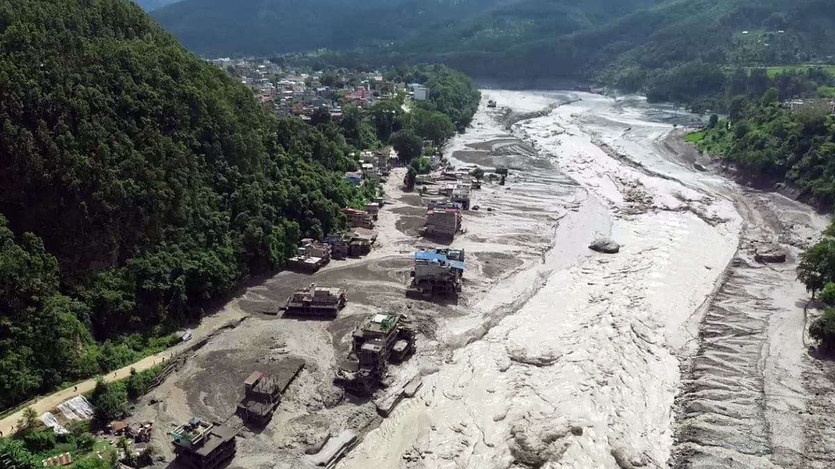
The Kosi is a river system that begins near Tibet and flows through Nepal and India.
It carries a huge amount of sand and mud from the young Himalayas.
This material settles in the river and can make the riverbed higher than the land beside it.
When that happens, the river may suddenly break out and make a new path.
This sudden change is called an avulsion.
The Kosi has shifted as much as 120 kilometers in Bihar over time.
In 2008, it returned toward an older course and flooded large areas.
Floods can also be caused by avalanches, glacier lake outbursts, landslides, and heavy rain.
Human-built embankments and bridges can sometimes increase the danger by trapping sediment and water.

A flash flood in Nepal’s Bhote Koshi River reportedly killed at least 95 people and left more than 384 missing.
The Kosi River flows about 720 kilometers through Tibet, Nepal, and India before reaching the Ganga.
Its tributaries carry roughly 100 million tonnes of sediment annually, helping create a growing megafan across about 10,000 square kilometers.
Heavy sediment deposits raise the riverbed and can trigger avulsions, or sudden shifts into new channels.
Flooding is also linked to avalanches, glacier lake outburst floods, landslides, cloudbursts, embankments, bridges, and land-use changes.
- Who
- The Bhote Koshi River flooded in Nepal, affecting people in Rasuwa district; Nepal and India jointly manage the wider Kosi system under the Indo-Nepal Koshi Agreement.
- What
- A flash flood struck the Bhote Koshi, while the article explains why the wider Kosi system is highly vulnerable to flooding and sudden channel shifts.
- When
- The flood occurred on a Wednesday morning, identified in the article as 26 August; the wider Kosi floods frequently during the monsoon.
- Where
- The flash flood occurred in Rasuwa district near the Nepal-Tibet boundary; the Kosi basin extends through Tibet, Nepal, and India, including Bihar.
- Why
- The river carries enormous sediment loads, changes course through avulsion, and is also exposed to avalanches, glacier lake outburst floods, landslides, cloudbursts, and risks associated with embankments and other structures.
Natural Drivers
Human Contributions
Main causes of flooding
Natural Drivers
The Kosi’s flooding is primarily driven by its enormous Himalayan sediment load, steep descent from the mountains, monsoon flows, avulsions, avalanches, glacier lake outburst floods, landslides, and cloudbursts.
Human Contributions
Embankments, bridges, riverbed congestion, and land-use and land-cover changes can increase sedimentation, erosion, landslides, and flood hazards.
Flood-control structures
Natural Drivers
The river’s highly dynamic channels and sediment-filled floodplains make flood prediction and risk mapping difficult even without major human intervention.
Human Contributions
The 1980 National Flood Commission report warned that confining sediment-laden rivers such as the Kosi with embankments can increase sedimentation and flood danger.
- Reported casualties
- At least 95 people were killed and more than 384 were reported missing in the Bhote Koshi flash flood.
- River length
- The main Kosi River course is approximately 720 kilometers long.
- Countries crossed
- The river system flows through Tibet, Nepal, and India.
- Annual sediment load
- The Kosi carries approximately 100 million tonnes of sediment annually at Chatara.
- Megafan size
- Its sediment deposits have formed a megafan of about 10,000 square kilometers.
- Major historical shift
- The river shifted 120 kilometers west in Bihar over 200 years and moved back toward its original course during the 2008 disaster.
- Flood-management agreement
- India and Nepal have managed the Kosi for flood control and water sharing under an agreement in place since 1954.