Archive · 27 Sep 2025
NISAR Satellite's First Radar Images Reveal Earth
The NISAR satellite, a collaboration between NASA and ISRO, has sent back its first radar images of Earth.
Launched in July, the satellite uses special radar to take pictures of the Earth every 12 days.
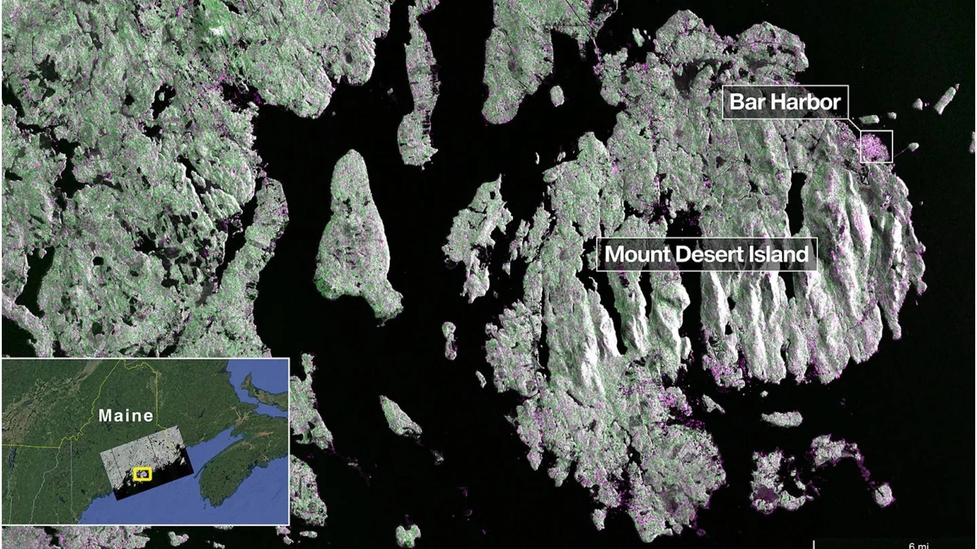
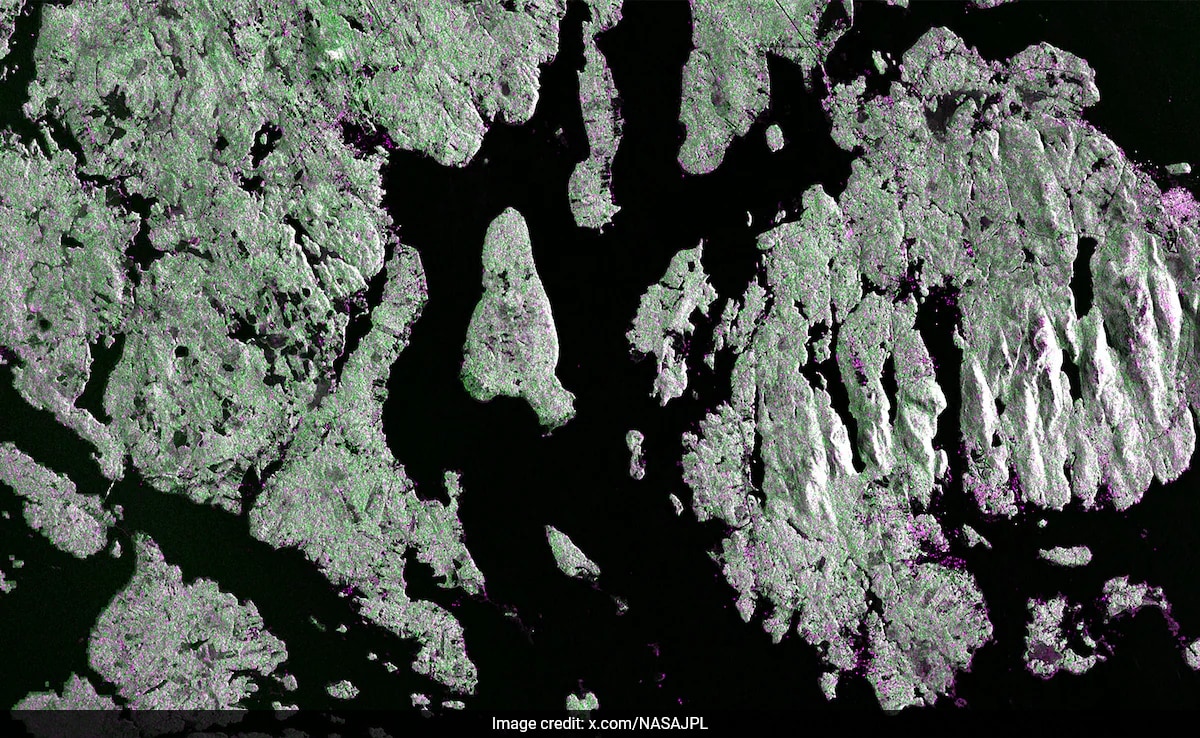
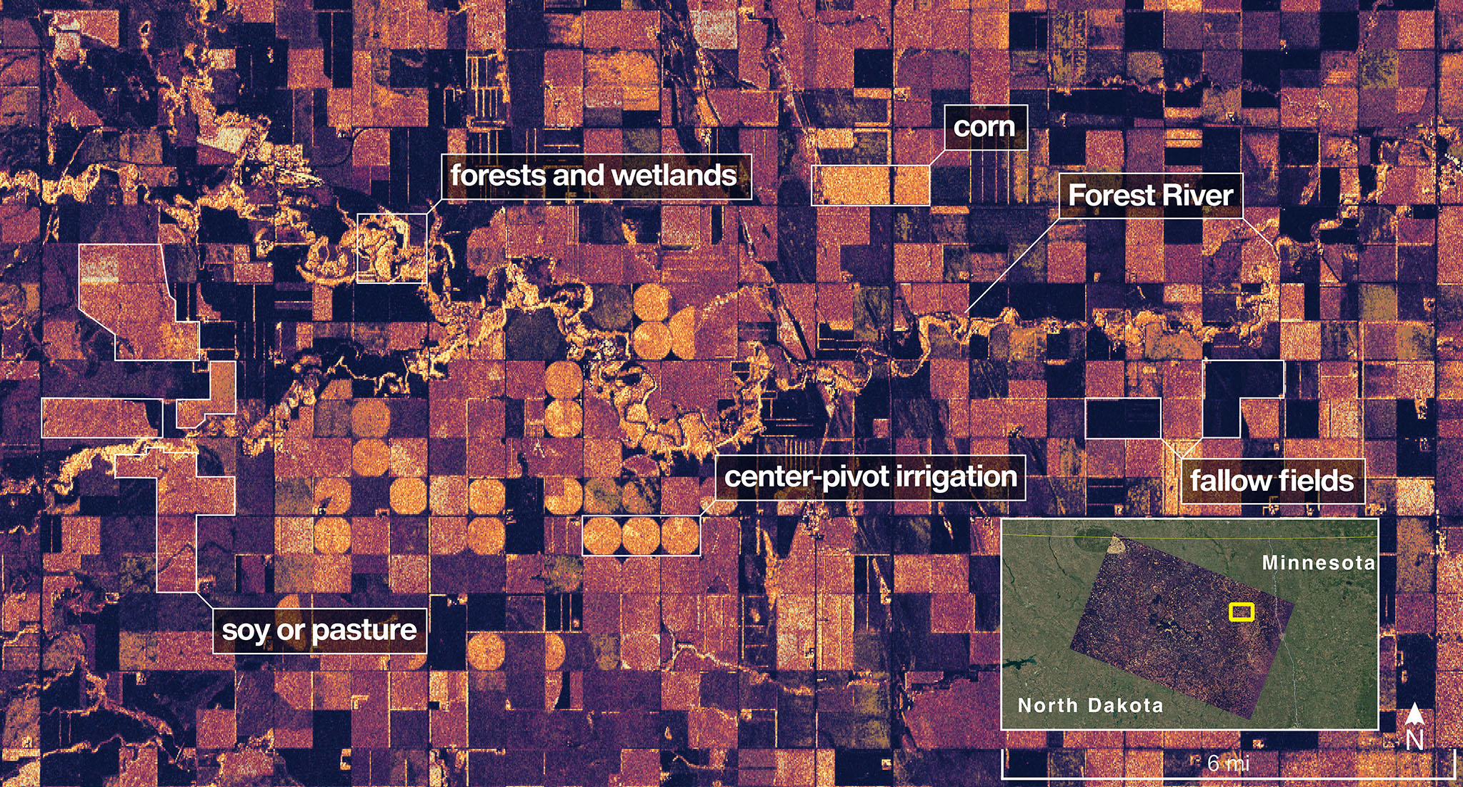
The first pictures showed parts of Maine and North Dakota, highlighting the ability to see different land features.
This data helps scientists study the Earth's surface, track climate change, monitor agriculture, and assist with disaster response, among other things.
The satellite will begin full operations in November 2025.

The NISAR satellite is a joint mission between NASA and ISRO.
NISAR launched on July 30, 2025, and has sent back its first radar images.
The satellite uses L-band and S-band radar systems to image the Earth.
Images show different land cover types, including water, forests, and buildings.
The satellite will image the entire Earth every 12 days and will begin full operations in November 2025.
- Who
- NASA and ISRO
- What
- First radar images of Earth from NISAR
- When
- Launched July 30, 2025; first images released August 2025; full operations begin November 2025
- Where
- Mount Desert Island, Maine; Forest River, North Dakota
- Why
- To gather detailed data about Earth's surface for scientific and practical applications.
- Satellite Name
- NISAR (NASA-ISRO Synthetic Aperture Radar)
- Partners
- NASA and ISRO
- Launch Date
- July 30, 2025
- Radar Bands
- L-band (NASA) and S-band (ISRO)
- Imaging Frequency
- Every 12 days
- First Imaging Location
- Mount Desert Island, Maine & Forest River, North Dakota
- Full Science Operations
- November 2025
Sources

From river to wetlands and farms, Isro-Nasa satellite NISAR captures first set of earth’s detailed images
Have You Seen First Radar Images Of Earth's Surface By NASA-ISRO Satellite Yet?
Nasa-Isro’s Nisar Sends Images of Earth