Archive · 19 Aug 2025
Ganga River Study: Old Satellite Data to Guide Revival

Scientists are looking at old and new pictures of the Ganga River to see how it has changed.
They are using pictures from 1965 taken by a spy satellite and comparing them to recent pictures.
This helps them see how things like buildings and farms have changed the river.
They're making a plan to help the Ganga get better, using maps and computers to share the information so everyone can help.

Project uses 1965 Corona satellite images and modern data to study Ganga changes.
IIT Kanpur leads the project to develop a data-driven blueprint.
Comparative analysis highlights impacts of urban expansion and agriculture.
A Web-GIS library is being created for future river management.
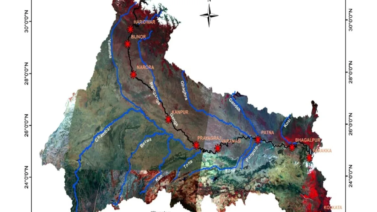
Special digital displays will be prepared for nine key locations.
- Who
- IIT Kanpur researchers and the National Mission for Clean Ganga (NMCG).
- What
- Project mapping changes in the Ganga River using satellite data.
- When
- Images from 1965 and 2018-2019 are being compared.
- Where
- Ganga River basin, focusing on nine key locations.
- Why
- To create a data-driven blueprint for the Ganga's conservation and restoration.
- Project Lead
- IIT Kanpur
- Initiating Organization
- National Mission for Clean Ganga (NMCG)
- Data Sources
- Corona satellite images (1965), modern imagery (2018-2019)
- Focus
- River morphology, flow, and land use changes
- Output
- Web-GIS library, digital displays for key locations
- Goal
- Data-driven decision-making for Ganga rejuvenation