

Archive · 29 Sep 2026
Google Satellite Images Reveal Gaza’s Destruction After Nearly Three Years
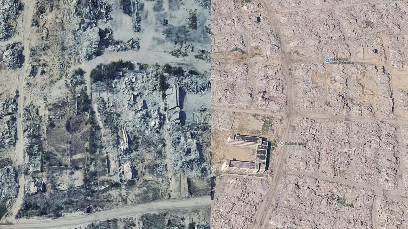
Google Maps has added new satellite pictures of Gaza.
The pictures let people compare places before the war with how they look now.
Many neighborhoods appear heavily damaged.
Farmland and buildings used by civilians were also affected.
The pictures were taken at different times, not all on one day.
Images of Rafah were taken in 2026.
Some images of northern Gaza were taken in 2025 and 2024.
The United Nations said that about 82 percent of Gaza’s structures had been damaged by June 16, 2026.

Updated Google Maps imagery shows widespread destruction across Gaza after nearly three years of war.
Images depict damaged neighborhoods, farmland, and civilian infrastructure throughout the Gaza Strip.
The imagery was captured on different dates rather than during one survey.
Rafah imagery was captured in 2026, while some northern Gaza images date to 2025 and 2024.
A United Nations assessment found that 201,290 structures, or about 82 percent of Gaza’s total, were damaged by June 16, 2026.
- Who
- The analysis involves Google Maps, Al Jazeera, and the United Nations; the destruction occurred during the Israel-Hamas war.
- What
- Updated satellite imagery shows extensive damage to Gaza’s neighborhoods, farmland, and civilian infrastructure.
- When
- The imagery includes pictures from 2024, 2025, and 2026; the United Nations assessment covers damage through June 16, 2026.
- Where
- Across the Gaza Strip, including Rafah in the south and areas of northern Gaza.
- Why
- The imagery provides a visual record of the scale of destruction, alongside a United Nations assessment of structural damage.
- Location
- Gaza Strip
- Conflict
- Israel-Hamas war
- Imagery source
- Google Maps satellite imagery
- Rafah imagery
- Captured in 2026
- Northern Gaza imagery
- Some images captured in 2025 and 2024
- Damage assessment date
- June 16, 2026
- Structures damaged
- 201,290, or about 82 percent of all structures in Gaza
- Structures destroyed
- 134,422