

Archive · 25 Jul 2026
200-Year-Old Indian Scroll Decoded: Ancient Navigation Secrets Revealed
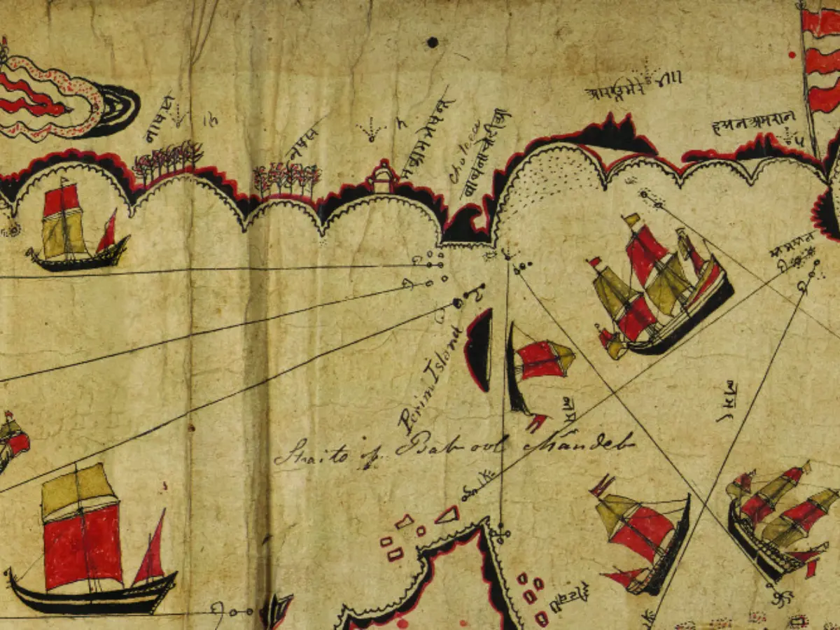
Scientists have decoded a 200-year-old Indian scroll that was used by sailors to navigate the Red Sea and Gulf of Aden.
This scroll, which was created by Kachchhi or Gujarati seafarers, is not just a map but a detailed navigation guide.
It uses stars, local knowledge, and memory to help sailors find their way.
The scroll has 66 place names, 29 rhumb lines, and over 180 islands and reefs.
It was acquired by a British explorer in 1835 and has been in the Royal Geographical Society's archives ever since.
The scroll shows that Indian Ocean mariners had their own effective navigation system long before modern tools like GPS were invented.

Researchers decoded a 200-year-old Gujarati navigational chart.
The scroll was a sophisticated navigation guide for Indian Ocean mariners.
It used stars, local knowledge, and memory for navigation.
The scroll contains 66 place names, 29 rhumb lines, and over 180 islands and reefs.
It was acquired by a British explorer in 1835 and has been in the Royal Geographical Society's archives.
- Who
- Researchers from the University of Exeter in the United Kingdom.
- What
- Decoded a 200-year-old Gujarati navigational chart.
- When
- The scroll was created in the late 18th or early 19th century.
- Where
- The scroll was found in the archives of Britain's Royal Geographical Society.
- Why
- To understand the sophisticated navigation system used by Indian Ocean mariners.
Traditional Navigation
Modern Navigation
Navigation Methods
Traditional Navigation
Relies on local knowledge, stars, and memory for navigation.
Modern Navigation
Uses GPS, compasses, and mathematical projections for navigation.
Map Design
Traditional Navigation
Prioritizes practical sailing directions and landmarks over perfect geographical accuracy.
Modern Navigation
Focuses on precise geographical accuracy and latitude-longitude grids.
User Assumption
Traditional Navigation
Assumes users already possess generations of maritime knowledge.
Modern Navigation
Designed for anyone to read and understand.
- Scroll Origin
- Created by Kachchhi or Gujarati seafarers in the late 18th or early 19th century.
- Scroll Dimensions
- 25 centimetres wide.
- Place Names
- 66 Devanagari place names.
- Rhumb Lines
- 29 carefully drawn rhumb lines.
- Islands and Reefs
- More than 180 islands and reefs.
- Acquisition Year
- 1835.
- Explorer
- Alexander Burnes.
- Archive
- Royal Geographical Society.