

World · North America · 9 hrs ago
Tornado watch issued as severe storms move across Oklahoma
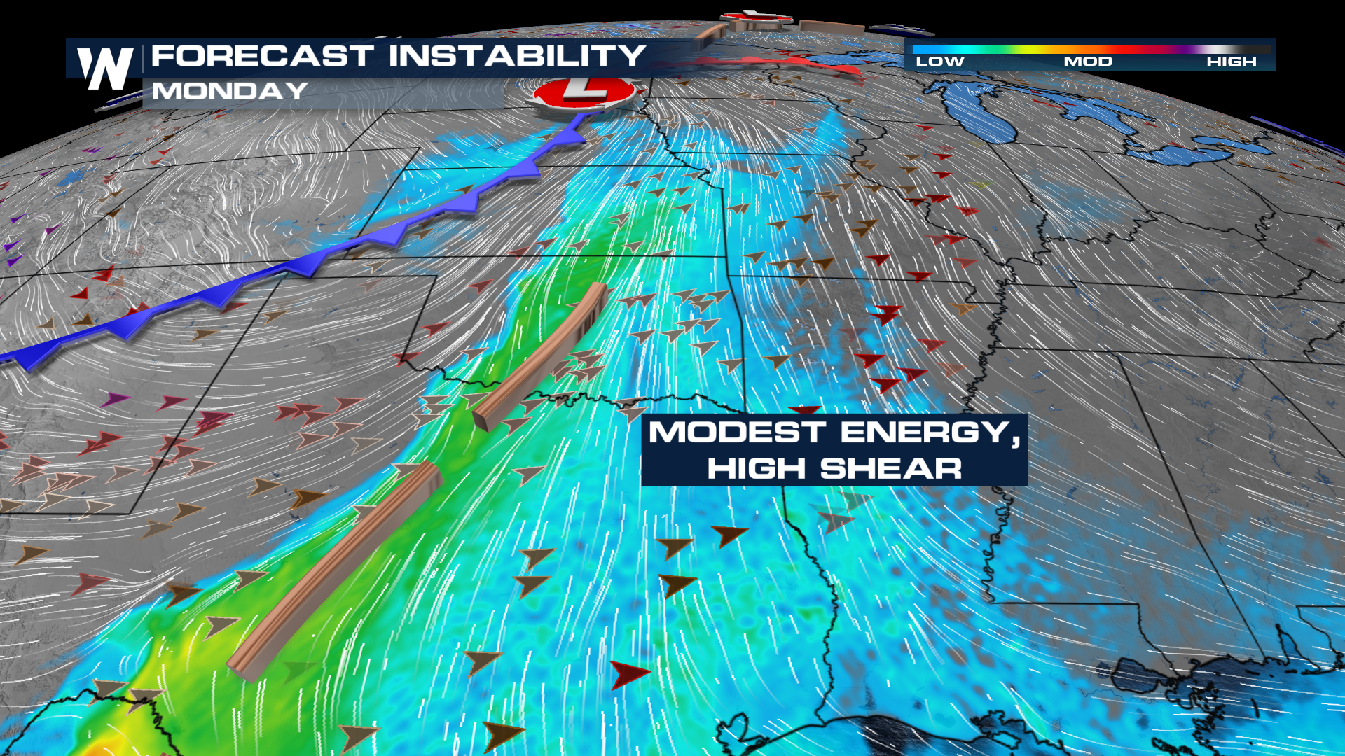
A tornado watch covers parts of western and central Oklahoma, including the Oklahoma City metro, as severe storms move through the state Monday.
Forecasters expect two rounds of storms, with the greater tornado threat in the second round.
The first storms may bring strong winds and small hail, while later storms could produce tornadoes, damaging winds and large hail.
The most serious risk is in north-central Oklahoma, though much of the state faces some level of severe-weather threat.
Storms are expected to move east, reaching central Oklahoma and the metro area in the evening before continuing into eastern Oklahoma overnight.
The watch remains in effect until 10 p.m.
Monday for the counties it covers, while severe weather could continue in parts of eastern Oklahoma until around midnight or later.
Residents are advised to stay alert for warnings and have a way to receive weather updates.

A tornado watch was issued for several counties in western and central Oklahoma, including the Oklahoma City metro, as severe storms moved across the state Monday.
The watch was in effect until 10 p.m. Monday.
Forecasters expected two waves of storms, with the second bringing the main tornado risk.
The storms could bring damaging winds and hail, and tornadoes were possible.
Severe weather was forecast to continue into the night and move east across Oklahoma.
- Who
- Residents in western and central Oklahoma, including the Oklahoma City metro, were under a tornado watch.
- What
- A tornado watch was issued as severe storms moved across Oklahoma.
- When
- Monday, November 2, 2026. The watch was in effect until 10 p.m.
- Where
- Several counties in western and central Oklahoma, including the Oklahoma City metro.
- Why
- Severe storms were forecast, with a risk of tornadoes, damaging winds and hail.
This story does not have two clearly opposing sides.
A few light showers and storms in far northwestern Oklahoma stayed below severe thunderstorm warning criteria.
Storms were forecast to form in central Oklahoma, just west and north of the Oklahoma City metro.
A second wave of storms was expected to bring a tornado risk as storms moved east across Oklahoma.
The tornado watch was set to expire.
Severe storms were forecast to move east and out of the KOKH viewing area.
- Tornado watch
- Several counties in western and central Oklahoma, including the Oklahoma City metro
- Watch expiration
- 10 p.m. Monday
- Forecast storm window
- 2 p.m. to midnight, varying by region
- Possible wind gusts
- 70–80 mph
- Possible hail
- Golf ball size
- Tornado risk
- KOKH said storms could produce tornadoes as high as EF2 criteria
3 sources
What people are saying
Those storms aren't expected to be tornadic, but they could be severe and pack a punch with small hail and strong wind gusts.
Wind gusts of 70-80 mph, golf ball size hail, and a medium tornado risk are all possible including in the OKC metro.
Right now, given the large amounts of shear, storms will try to rotate on Monday.